Ovacık geodata
Ovacık (Mersin) is a seat of a third-order administrative division; located in Turkey in Europe/Istanbul (GMT+3) time zone. In our database, there are 1323 cities with bigger population. Compared to other cities in Turkey, 98.8% of cities are located further ↑North; 59.9% of cities are located further →East and 89.2% of cities have higher elevation than Ovacık. Note1


Ovacık GPS coordinates[2]
36° 10' 16.752" North, 33° 33' 20.916" East
| Map corner | latitude | longitude |
|---|---|---|
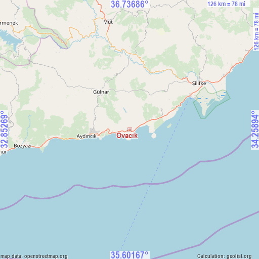
| Upper-left | 36.73686°, | 32.85269° |
| Center: | 36.17132°, | 33.55581° |
| Lower-right: | 35.60167°, | 34.25894° |
| Map W x H: | 126.2×126.2 km | = 78.4×78.4mi |
| max Lat: | 42.02683° ⇑98.8% North |
| Ovacık: | 36.17132° |
| min Lat: | ⇓1.2% South 35.9025° |
| min Long | Ovacık | max Long |
| 25.90902° | 33.55581° | 44.60099° |
| W 40.1%⇐ | ⇒59.9% E |
Elevation
Elevation of Ovacık is 43 m = 141 ft, and this is 674.4 m = 2213 ft below average elevation for this country.
| Max E: |
2682 m = 8799 ft | 89.2% |
| Avg. | 717.4 m = 2354 ft | |
| Ovacık | 43 m = 141 ft | |
Min E: |
0 m = 0 ft | 10.8% |
See also: Turkey elevation on elevation.city.
Geographical zone
Ovacık is located in North temperate zone (between Tropic of Cancer and the Arctic Circle). Distance of this Northern Tropic circle is 1416 km =879.9 mi to South.| Distance of | km | miles | from Ovacık |
|---|---|---|---|
| North Pole | 5985.2 | 3719 | to North |
| Arctic Circle | 3379.3 | 2099.8 | to North |
| Tropic Cancer | 1416 | 879.9 | to South |
| Equator | 4021.9 | 2499.1 | to South |


Nearby cities:
15 places around Ovacık: (largest is in red/bold)
• Akdere
19.1 km =11.9 mi,  66°
66°
• Anamur
65.4 km =40.6 mi,  260°
260°
• Aydıncık
21.4 km =13.3 mi, 261°
• Bozyazı
53.9 km =33.5 mi, 262°
• Erdemli
82.8 km =51.4 mi,  54°
54°
• Ermenek
79.1 km =49.2 mi,  311°
311°
• Gülnar
23.6 km =14.7 mi,  323°
323°
• Kazancı
72.3 km =44.9 mi,  300°
300°
• Kocahasanlı
79 km =49.1 mi, 54°
• Kırobası
67.3 km =41.8 mi,  24°
24°
• Kızkalesi
61.7 km =38.3 mi,  58°
58°
• Mut
53.6 km =33.3 mi,  348°
348°
• Sarıkavak
46.2 km =28.7 mi,  9°
9°
• Silifke
41 km =25.5 mi, 55°
• Taşucu
33.6 km =20.9 mi, 60°
Sources, notices
• [Note1] Compared only with cities in Turkey existing in our database
• [Src1] Map data: © OpenStreetMap contributors (CC-BY-SA)
• [Src2] Other city data from geonames.org with taken over terms of usage.
• [Src3] Geographical zone / Annual Mean Temperature by Robert A. Rohde @ Wikipedia
