Kılbasan geodata
Kılbasan (Karaman) is a seat of a third-order administrative division; located in Turkey in Europe/Istanbul (GMT+3) time zone. In our database, there are 1323 cities with bigger population. Compared to other cities in Turkey, 79.6% of cities are located further ↑North; 61.6% of cities are located further →East and 68.8% of cities have lower elevation than Kılbasan. Note1


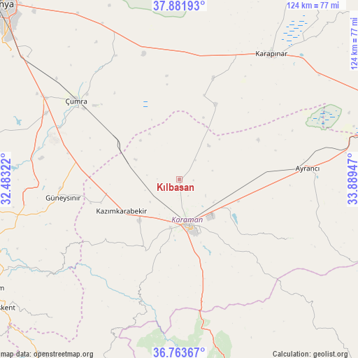
Kılbasan GPS coordinates[2]
37° 19' 29.568" North, 33° 11' 10.824" East
| Map corner | latitude | longitude |
|---|---|---|
| Upper-left | 37.88193°, | 32.48322° |
| Center: | 37.32488°, | 33.18634° |
| Lower-right: | 36.76367°, | 33.88947° |
| Map W x H: | 124.3×124.3 km | = 77.2×77.2mi |
| max Lat: | 42.02683° ⇑79.6% North |
| Kılbasan: | 37.32488° |
| min Lat: | ⇓20.4% South 35.9025° |
| min Long | Kılbasan | max Long |
| 25.90902° | 33.18634° | 44.60099° |
| W 38.4%⇐ | ⇒61.6% E |
Elevation
Elevation of Kılbasan is 1012 m = 3320 ft, and this is 294.6 m = 967 ft above average elevation for this country.
| Max E: |
2682 m = 8799 ft | 31.2% |
| Kılbasan | 1012 m 3320 ft | |
| Avg. | 717.4 m = 2354 ft | |
Min E: |
0 m = 0 ft | 68.8% |
See also: Turkey elevation on elevation.city.
Geographical zone
Kılbasan is located in North temperate zone (between Tropic of Cancer and the Arctic Circle). Distance of this Northern Tropic circle is 1544.2 km =959.5 mi to South.| Distance of | km | miles | from Kılbasan |
|---|---|---|---|
| North Pole | 5856.9 | 3639.3 | to North |
| Arctic Circle | 3251 | 2020.1 | to North |
| Tropic Cancer | 1544.2 | 959.5 | to South |
| Equator | 4150.1 | 2578.8 | to South |


Nearby cities:
15 places around Kılbasan: (largest is in red/bold)
• Ayrancı
44.6 km =27.7 mi,  84°
84°
• Belören
57.3 km =35.6 mi,  257°
257°
• Bucakkışla
43.7 km =27.2 mi,  199°
199°
• Dinek
50.4 km =31.3 mi,  269°
269°
• Güneysınır
40.9 km =25.4 mi, 261°
• Hotamış
36.9 km =22.9 mi,  18°
18°
• Karaman
16.2 km =10.1 mi,  170°
170°
• Karapınar
54.1 km =33.6 mi,  36°
36°
• Kazımkarabekir
22.7 km =14.1 mi,  242°
242°
• Ovakavağı
48.3 km =30 mi,  332°
332°
• Yeşildere
34.5 km =21.4 mi,  122°
122°
• Çatalhöyük
49.6 km =30.8 mi,  320°
320°
• Çiğil
20.7 km =12.9 mi,  34°
34°
• Çumra
45.7 km =28.4 mi,  307°
307°
• İnönü
51.3 km =31.9 mi,  91°
91°
Sources, notices
• [Note1] Compared only with cities in Turkey existing in our database
• [Src1] Map data: © OpenStreetMap contributors (CC-BY-SA)
• [Src2] Other city data from geonames.org with taken over terms of usage.
• [Src3] Geographical zone / Annual Mean Temperature by Robert A. Rohde @ Wikipedia
