Ayrancı geodata
Ayrancı (Karaman) is a seat of a second-order administrative division; located in Turkey in Europe/Istanbul (GMT+3) time zone. In our database, there are 1323 cities with bigger population. Compared to other cities in Turkey, 78.8% of cities are located further ↑North; 59.6% of cities are located further →East and 77.1% of cities have lower elevation than Ayrancı. Note1


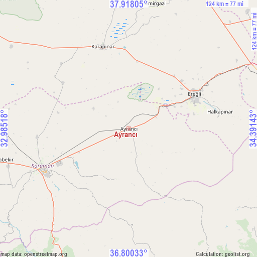
Ayrancı GPS coordinates[2]
37° 21' 40.572" North, 33° 41' 17.88" East
| Map corner | latitude | longitude |
|---|---|---|
| Upper-left | 37.91805°, | 32.98518° |
| Center: | 37.36127°, | 33.6883° |
| Lower-right: | 36.80033°, | 34.39143° |
| Map W x H: | 124.3×124.3 km | = 77.2×77.2mi |
| max Lat: | 42.02683° ⇑78.8% North |
| Ayrancı: | 37.36127° |
| min Lat: | ⇓21.2% South 35.9025° |
| min Long | Ayrancı | max Long |
| 25.90902° | 33.6883° | 44.60099° |
| W 40.4%⇐ | ⇒59.6% E |
Elevation
Elevation of Ayrancı is 1139 m = 3737 ft, and this is 421.6 m = 1383 ft above average elevation for this country.
| Max E: |
2682 m = 8799 ft | 22.9% |
| Ayrancı | 1139 m 3737 ft | |
| Avg. | 717.4 m = 2354 ft | |
Min E: |
0 m = 0 ft | 77.1% |
See also: Turkey elevation on elevation.city.
Geographical zone
Ayrancı is located in North temperate zone (between Tropic of Cancer and the Arctic Circle). Distance of this Northern Tropic circle is 1548.3 km =962.1 mi to South.| Distance of | km | miles | from Ayrancı |
|---|---|---|---|
| North Pole | 5852.9 | 3636.8 | to North |
| Arctic Circle | 3247 | 2017.6 | to North |
| Tropic Cancer | 1548.3 | 962.1 | to South |
| Equator | 4154.2 | 2581.3 | to South |


Nearby cities:
15 places around Ayrancı: (largest is in red/bold)
• Arslanköy
65.3 km =40.6 mi,  125°
125°
• Beyviran
56.3 km =35 mi,  15°
15°
• Emirgazi
61.6 km =38.3 mi,  12°
12°
• Ereğli
35.9 km =22.3 mi,  61°
61°
• Güzeloluk
72.1 km =44.8 mi,  150°
150°
• Halkapınar
44.8 km =27.8 mi,  79°
79°
• Hotamış
45 km =28 mi,  313°
313°
• Karaman
46.4 km =28.8 mi,  244°
244°
• Karapınar
41.3 km =25.7 mi,  342°
342°
• Kazımkarabekir
66.1 km =41.1 mi,  257°
257°
• Kılbasan
44.6 km =27.7 mi, 264°
• Kırobası
72.8 km =45.2 mi,  167°
167°
• Yeşildere
27.5 km =17.1 mi,  214°
214°
• Çiğil
35.2 km =21.9 mi,  291°
291°
• İnönü
8.5 km =5.3 mi, 125°
Sources, notices
• [Note1] Compared only with cities in Turkey existing in our database
• [Src1] Map data: © OpenStreetMap contributors (CC-BY-SA)
• [Src2] Other city data from geonames.org with taken over terms of usage.
• [Src3] Geographical zone / Annual Mean Temperature by Robert A. Rohde @ Wikipedia
