Karaman geodata
Karaman is a seat of a first-order administrative division; located in Turkey in Europe/Istanbul (GMT+3) time zone. With population of 120,399 people, there are 72 cities with bigger population in this country. Compared to other cities in Turkey, 83.9% of cities are located further ↑North; 61.5% of cities are located further →East and 70.8% of cities have lower elevation than Karaman. Note1


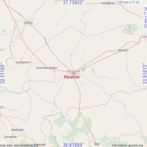
Karaman GPS coordinates[2]
37° 10' 51.996" North, 33° 12' 54" East
| Map corner | latitude | longitude |
|---|---|---|
| Upper-left | 37.73923°, | 32.51188° |
| Center: | 37.18111°, | 33.215° |
| Lower-right: | 36.61884°, | 33.91813° |
| Map W x H: | 124.6×124.6 km | = 77.4×77.4mi |
| max Lat: | 42.02683° ⇑83.9% North |
| Karaman: | 37.18111° |
| min Lat: | ⇓16.1% South 35.9025° |
| min Long | Karaman | max Long |
| 25.90902° | 33.215° | 44.60099° |
| W 38.5%⇐ | ⇒61.5% E |
Elevation
Elevation of Karaman is 1037 m = 3402 ft, and this is 319.6 m = 1049 ft above average elevation for this country.
| Max E: |
2682 m = 8799 ft | 29.2% |
| Karaman | 1037 m 3402 ft | |
| Avg. | 717.4 m = 2354 ft | |
Min E: |
0 m = 0 ft | 70.8% |
See also: Karaman elevation on elevation.city.
Geographical zone
Karaman is located in North temperate zone (between Tropic of Cancer and the Arctic Circle). Distance of this Northern Tropic circle is 1528.2 km =949.6 mi to South.| Distance of | km | miles | from Karaman |
|---|---|---|---|
| North Pole | 5872.9 | 3649.2 | to North |
| Arctic Circle | 3267 | 2030 | to North |
| Tropic Cancer | 1528.2 | 949.6 | to South |
| Equator | 4134.2 | 2568.9 | to South |


Nearby cities:
15 places around Karaman: (largest is in red/bold)
• Ayrancı
46.4 km =28.8 mi,  64°
64°
• Belören
58.7 km =36.5 mi,  273°
273°
• Bucakkışla
30.5 km =19 mi,  214°
214°
• Dinek
55.4 km =34.4 mi,  286°
286°
• Güneysınır
44.1 km =27.4 mi,  282°
282°
• Hotamış
51.8 km =32.2 mi,  10°
10°
• Kazımkarabekir
23.3 km =14.5 mi, 283°
• Kılbasan
16.2 km =10.1 mi,  350°
350°
• Mut
63 km =39.1 mi,  161°
161°
• Ovakavağı
63.9 km =39.7 mi,  337°
337°
• Yeşildere
26.7 km =16.6 mi,  95°
95°
• Çatalhöyük
64.1 km =39.8 mi,  327°
327°
• Çiğil
34.4 km =21.4 mi,  15°
15°
• Çumra
58.4 km =36.3 mi,  318°
318°
• İnönü
51.1 km =31.8 mi,  72°
72°
Sources, notices
• [Note1] Compared only with cities in Turkey existing in our database
• [Src1] Map data: © OpenStreetMap contributors (CC-BY-SA)
• [Src2] Other city data from geonames.org with taken over terms of usage.
• [Src3] Geographical zone / Annual Mean Temperature by Robert A. Rohde @ Wikipedia
