Adala geodata
Adala (Manisa) is a seat of a third-order administrative division; located in Turkey in Europe/Istanbul (GMT+3) time zone. In our database, there are 1323 cities with bigger population. Compared to other cities in Turkey, 51.8% of cities are located further ↑North; 88.4% of cities are located further →East and 79.9% of cities have higher elevation than Adala. Note1


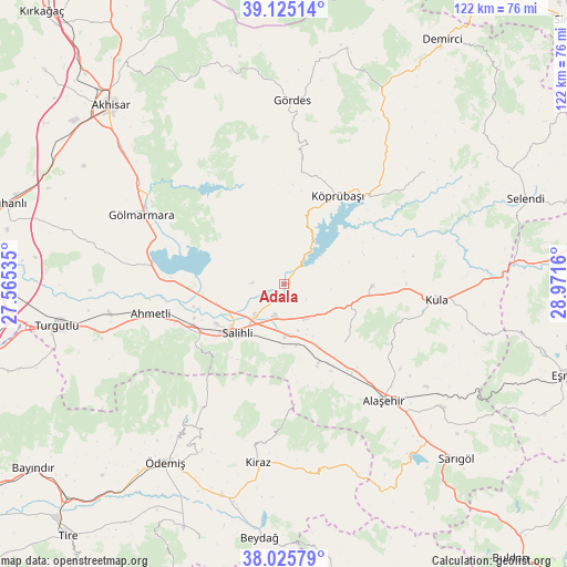
Adala GPS coordinates[2]
38° 34' 39.252" North, 28° 16' 6.492" East
| Map corner | latitude | longitude |
|---|---|---|
| Upper-left | 39.12514°, | 27.56535° |
| Center: | 38.57757°, | 28.26847° |
| Lower-right: | 38.02579°, | 28.9716° |
| Map W x H: | 122.2×122.2 km | = 75.9×75.9mi |
| max Lat: | 42.02683° ⇑51.8% North |
| Adala: | 38.57757° |
| min Lat: | ⇓48.2% South 35.9025° |
| min Long | Adala | max Long |
| 25.90902° | 28.26847° | 44.60099° |
| W 11.6%⇐ | ⇒88.4% E |
Elevation
Elevation of Adala is 117 m = 384 ft, and this is 600.4 m = 1970 ft below average elevation for this country.
| Max E: |
2682 m = 8799 ft | 79.9% |
| Avg. | 717.4 m = 2354 ft | |
| Adala | 117 m = 384 ft | |
Min E: |
0 m = 0 ft | 20.1% |
See also: Turkey elevation on elevation.city.
Geographical zone
Adala is located in North temperate zone (between Tropic of Cancer and the Arctic Circle). Distance of this Northern Tropic circle is 1683.5 km =1046.1 mi to South.| Distance of | km | miles | from Adala |
|---|---|---|---|
| North Pole | 5717.6 | 3552.8 | to North |
| Arctic Circle | 3111.8 | 1933.6 | to North |
| Tropic Cancer | 1683.5 | 1046.1 | to South |
| Equator | 4289.4 | 2665.3 | to South |


Nearby cities:
15 places around Adala: (largest is in red/bold)
• Ahmetli
29.4 km =18.3 mi,  257°
257°
• Alaşehir
33.2 km =20.6 mi,  139°
139°
• Birgi
40.7 km =25.3 mi,  206°
206°
• Borlu
26 km =16.2 mi,  41°
41°
• Gölmarmara
34.3 km =21.3 mi,  296°
296°
• Gördes
39.5 km =24.5 mi,  2°
2°
• Kaymakçı
47.5 km =29.5 mi,  196°
196°
• Kiraz
39 km =24.2 mi,  188°
188°
• Kula
33.3 km =20.7 mi,  95°
95°
• Köprübaşı
22.5 km =14 mi,  31°
31°
• Menye
19.2 km =11.9 mi,  90°
90°
• Salihli
14.9 km =9.3 mi,  224°
224°
• Yeşilyurt
43.5 km =27 mi,  127°
127°
• Çaylı
48.4 km =30.1 mi, 192°
• Ödemiş
46.8 km =29.1 mi, 213°
Sources, notices
• [Note1] Compared only with cities in Turkey existing in our database
• [Src1] Map data: © OpenStreetMap contributors (CC-BY-SA)
• [Src2] Other city data from geonames.org with taken over terms of usage.
• [Src3] Geographical zone / Annual Mean Temperature by Robert A. Rohde @ Wikipedia
