Cumaçay geodata
Cumaçay (Ağrı) is a seat of a third-order administrative division; located in Turkey in Europe/Istanbul (GMT+3) time zone. In our database, there are 1323 cities with bigger population. Compared to other cities in Turkey, 67.8% of cities are located further ↓South; 97.6% of cities are located further ←West and 98.8% of cities have lower elevation than Cumaçay. Note1


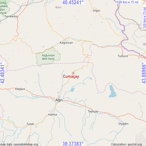
Cumaçay GPS coordinates[2]
39° 54' 54.864" North, 43° 11' 11.508" East
| Map corner | latitude | longitude |
|---|---|---|
| Upper-left | 40.45241°, | 42.48341° |
| Center: | 39.91524°, | 43.18653° |
| Lower-right: | 39.37383°, | 43.88966° |
| Map W x H: | 119.9×119.9 km | = 74.5×74.5mi |
| max Lat: | 42.02683° ⇑32.2% North |
| Cumaçay: | 39.91524° |
| min Lat: | ⇓67.8% South 35.9025° |
| min Long | Cumaçay | max Long |
| 25.90902° | 43.18653° | 44.60099° |
| W 97.6%⇐ | ⇒2.4% E |
Elevation
Elevation of Cumaçay is 1959 m = 6427 ft, and this is 1241.6 m = 4073 ft above average elevation for this country.
| Max E: |
2682 m = 8799 ft | 1.2% |
| Cumaçay | 1959 m 6427 ft | |
| Avg. | 717.4 m = 2354 ft | |
Min E: |
0 m = 0 ft | 98.8% |
See also: Turkey elevation on elevation.city.
Geographical zone
Cumaçay is located in North temperate zone (between Tropic of Cancer and the Arctic Circle). Distance of this Northern Tropic circle is 1832.2 km =1138.5 mi to South.| Distance of | km | miles | from Cumaçay |
|---|---|---|---|
| North Pole | 5568.9 | 3460.4 | to North |
| Arctic Circle | 2963 | 1841.1 | to North |
| Tropic Cancer | 1832.2 | 1138.5 | to South |
| Equator | 4438.2 | 2757.8 | to South |


Nearby cities:
15 places around Cumaçay: (largest is in red/bold)
• Ağrı
24.6 km =15.3 mi,  207°
207°
• Digor
53.9 km =33.5 mi,  20°
20°
• Diyadin
58.8 km =36.5 mi,  135°
135°
• Eleşkirt
45.5 km =28.3 mi,  253°
253°
• Gaziler
29.2 km =18.1 mi,  50°
50°
• Hamur
38.5 km =23.9 mi, 206°
• Karakoyunlu
38.2 km =23.7 mi,  97°
97°
• Karakurt
56.8 km =35.3 mi,  299°
299°
• Kağızman
27.2 km =16.9 mi,  350°
350°
• Kötek
37.2 km =23.1 mi,  335°
335°
• Murat
27.3 km =17 mi,  170°
170°
• Suluçem
59 km =36.7 mi,  114°
114°
• Taşlıçay
35.4 km =22 mi,  153°
153°
• Tutak
55.2 km =34.3 mi,  220°
220°
• Tuzluca
42 km =26.1 mi,  70°
70°
Sources, notices
• [Note1] Compared only with cities in Turkey existing in our database
• [Src1] Map data: © OpenStreetMap contributors (CC-BY-SA)
• [Src2] Other city data from geonames.org with taken over terms of usage.
• [Src3] Geographical zone / Annual Mean Temperature by Robert A. Rohde @ Wikipedia
