Tuzluca geodata
Tuzluca (Iğdır) is a seat of a second-order administrative division; located in Turkey in Europe/Istanbul (GMT+3) time zone. In our database, there are 1323 cities with bigger population. Compared to other cities in Turkey, 69.8% of cities are located further ↓South; 99.1% of cities are located further ←West and 76.1% of cities have lower elevation than Tuzluca. Note1


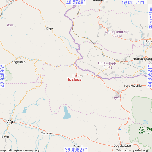
Tuzluca GPS coordinates[2]
40° 2' 19.356" North, 43° 39' 7.488" East
| Map corner | latitude | longitude |
|---|---|---|
| Upper-left | 40.5749°, | 42.94896° |
| Center: | 40.03871°, | 43.65208° |
| Lower-right: | 39.49827°, | 44.35521° |
| Map W x H: | 119.7×119.7 km | = 74.4×74.4mi |
| max Lat: | 42.02683° ⇑30.2% North |
| Tuzluca: | 40.03871° |
| min Lat: | ⇓69.8% South 35.9025° |
| min Long | Tuzluca | max Long |
| 25.90902° | 43.65208° | 44.60099° |
| W 99.1%⇐ | ⇒0.90000000000001% E |
Elevation
Elevation of Tuzluca is 1123 m = 3684 ft, and this is 405.6 m = 1331 ft above average elevation for this country.
| Max E: |
2682 m = 8799 ft | 23.9% |
| Tuzluca | 1123 m 3684 ft | |
| Avg. | 717.4 m = 2354 ft | |
Min E: |
0 m = 0 ft | 76.1% |
See also: Turkey elevation on elevation.city.
Geographical zone
Tuzluca is located in North temperate zone (between Tropic of Cancer and the Arctic Circle). Distance of this Northern Tropic circle is 1846 km =1147.1 mi to South.| Distance of | km | miles | from Tuzluca |
|---|---|---|---|
| North Pole | 5555.2 | 3451.8 | to North |
| Arctic Circle | 2949.3 | 1832.6 | to North |
| Tropic Cancer | 1846 | 1147.1 | to South |
| Equator | 4451.9 | 2766.3 | to South |


Nearby cities:
15 places around Tuzluca: (largest is in red/bold)
• Ağrı
62.3 km =38.7 mi,  235°
235°
• Başgedikler
67.8 km =42.1 mi,  350°
350°
• Cumaçay
42 km =26.1 mi,  250°
250°
• Digor
42.1 km =26.2 mi,  330°
330°
• Diyadin
55.4 km =34.4 mi,  178°
178°
• Doğubayazıt
66 km =41 mi,  145°
145°
• Gaziler
17.7 km =11 mi,  285°
285°
• Iğdır
35.8 km =22.2 mi,  110°
110°
• Karakoyunlu
18.8 km =11.7 mi,  185°
185°
• Kağızman
46 km =28.6 mi, 286°
• Kötek
58.8 km =36.5 mi, 289°
• Murat
53.8 km =33.4 mi,  220°
220°
• Suluçem
40.8 km =25.4 mi,  160°
160°
• Taşburun
49 km =30.4 mi,  96°
96°
• Taşlıçay
51.5 km =32 mi,  208°
208°
Sources, notices
• [Note1] Compared only with cities in Turkey existing in our database
• [Src1] Map data: © OpenStreetMap contributors (CC-BY-SA)
• [Src2] Other city data from geonames.org with taken over terms of usage.
• [Src3] Geographical zone / Annual Mean Temperature by Robert A. Rohde @ Wikipedia
