Baskil geodata
Baskil (Elazığ) is a seat of a second-order administrative division; located in Turkey in Europe/Istanbul (GMT+3) time zone. With population of 15,922 people, there are 379 cities with bigger population in this country. Compared to other cities in Turkey, 52.1% of cities are located further ↑North; 66.2% of cities are located further ←West and 80.6% of cities have lower elevation than Baskil. Note1


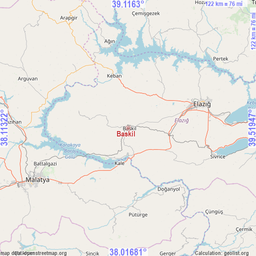
Baskil GPS coordinates[2]
38° 34' 7.176" North, 38° 48' 58.824" East
| Map corner | latitude | longitude |
|---|---|---|
| Upper-left | 39.1163°, | 38.11322° |
| Center: | 38.56866°, | 38.81634° |
| Lower-right: | 38.01681°, | 39.51947° |
| Map W x H: | 122.3×122.3 km | = 76×76mi |
| max Lat: | 42.02683° ⇑52.1% North |
| Baskil: | 38.56866° |
| min Lat: | ⇓47.9% South 35.9025° |
| min Long | Baskil | max Long |
| 25.90902° | 38.81634° | 44.60099° |
| W 66.2%⇐ | ⇒33.8% E |
Elevation
Elevation of Baskil is 1206 m = 3957 ft, and this is 488.6 m = 1603 ft above average elevation for this country.
| Max E: |
2682 m = 8799 ft | 19.4% |
| Baskil | 1206 m 3957 ft | |
| Avg. | 717.4 m = 2354 ft | |
Min E: |
0 m = 0 ft | 80.6% |
See also: Turkey elevation on elevation.city.
Geographical zone
Baskil is located in North temperate zone (between Tropic of Cancer and the Arctic Circle). Distance of this Northern Tropic circle is 1682.5 km =1045.5 mi to South.| Distance of | km | miles | from Baskil |
|---|---|---|---|
| North Pole | 5718.6 | 3553.4 | to North |
| Arctic Circle | 3112.7 | 1934.1 | to North |
| Tropic Cancer | 1682.5 | 1045.5 | to South |
| Equator | 4288.4 | 2664.7 | to South |


Nearby cities:
15 places around Baskil: (largest is in red/bold)
• Aydınlar
24.7 km =15.3 mi,  283°
283°
• Ağın
42.1 km =26.2 mi,  347°
347°
• Doğanyol
34.7 km =21.6 mi,  146°
146°
• Elazığ
37.2 km =23.1 mi,  71°
71°
• Gözeli
26.4 km =16.4 mi,  127°
127°
• Hankendi
21 km =13 mi,  89°
89°
• Harput
39.9 km =24.8 mi, 67°
• Hıdırbaba
26.1 km =16.2 mi,  32°
32°
• Kale
17.5 km =10.9 mi,  193°
193°
• Keban
26 km =16.2 mi,  344°
344°
• Kuşsarayı
17.7 km =11 mi,  222°
222°
• Poyraz
22.2 km =13.8 mi,  53°
53°
• Pütürge
41.3 km =25.7 mi,  174°
174°
• Taşdelen
40.4 km =25.1 mi,  317°
317°
• Çolaklı
36.8 km =22.9 mi, 224°
Sources, notices
• [Note1] Compared only with cities in Turkey existing in our database
• [Src1] Map data: © OpenStreetMap contributors (CC-BY-SA)
• [Src2] Other city data from geonames.org with taken over terms of usage.
• [Src3] Geographical zone / Annual Mean Temperature by Robert A. Rohde @ Wikipedia
