Kale geodata
Kale (Malatya) is a seat of a second-order administrative division; located in Turkey in Europe/Istanbul (GMT+3) time zone. In our database, there are 1323 cities with bigger population. Compared to other cities in Turkey, 54.2% of cities are located further ↑North; 65.7% of cities are located further ←West and 53.2% of cities have lower elevation than Kale. Note1


Kale GPS coordinates[2]
38° 24' 55.368" North, 38° 46' 15.312" East
| Map corner | latitude | longitude |
|---|---|---|
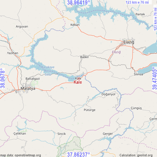
| Upper-left | 38.96419°, | 38.0678° |
| Center: | 38.41538°, | 38.77092° |
| Lower-right: | 37.86237°, | 39.47405° |
| Map W x H: | 122.5×122.5 km | = 76.1×76.1mi |
| max Lat: | 42.02683° ⇑54.2% North |
| Kale: | 38.41538° |
| min Lat: | ⇓45.8% South 35.9025° |
| min Long | Kale | max Long |
| 25.90902° | 38.77092° | 44.60099° |
| W 65.7%⇐ | ⇒34.3% E |
Elevation
Elevation of Kale is 761 m = 2497 ft, and this is 43.6 m = 143 ft above average elevation for this country.
| Max E: |
2682 m = 8799 ft | 46.8% |
| Kale | 761 m 2497 ft | |
| Avg. | 717.4 m = 2354 ft | |
Min E: |
0 m = 0 ft | 53.2% |
See also: Turkey elevation on elevation.city.
Geographical zone
Kale is located in North temperate zone (between Tropic of Cancer and the Arctic Circle). Distance of this Northern Tropic circle is 1665.5 km =1034.9 mi to South.| Distance of | km | miles | from Kale |
|---|---|---|---|
| North Pole | 5735.7 | 3564 | to North |
| Arctic Circle | 3129.8 | 1944.8 | to North |
| Tropic Cancer | 1665.5 | 1034.9 | to South |
| Equator | 4271.4 | 2654.1 | to South |


Nearby cities:
15 places around Kale: (largest is in red/bold)
• Aydınlar
30.5 km =19 mi,  318°
318°
• Baskil
17.5 km =10.9 mi,  13°
13°
• Battalgazi
35.9 km =22.3 mi,  271°
271°
• Doğanyol
25.9 km =16.1 mi,  117°
117°
• Gözeli
25 km =15.5 mi,  87°
87°
• Hankendi
30.2 km =18.8 mi,  55°
55°
• Hıdırbaba
43 km =26.7 mi,  24°
24°
• Keban
42.2 km =26.2 mi,  355°
355°
• Kuşsarayı
8.9 km =5.5 mi,  296°
296°
• Malatya
40.3 km =25 mi,  259°
259°
• Poyraz
37.2 km =23.1 mi,  36°
36°
• Pütürge
25.3 km =15.7 mi,  161°
161°
• Taraksu
43.9 km =27.3 mi,  131°
131°
• Tepehan
33.3 km =20.7 mi,  186°
186°
• Çolaklı
23.7 km =14.7 mi,  247°
247°
Sources, notices
• [Note1] Compared only with cities in Turkey existing in our database
• [Src1] Map data: © OpenStreetMap contributors (CC-BY-SA)
• [Src2] Other city data from geonames.org with taken over terms of usage.
• [Src3] Geographical zone / Annual Mean Temperature by Robert A. Rohde @ Wikipedia
