Hazekyan geodata
Hazekyan (Hakkâri) is a seat of a third-order administrative division; located in Turkey in Europe/Istanbul (GMT+3) time zone. In our database, there are 1323 cities with bigger population. Compared to other cities in Turkey, 70.1% of cities are located further ↑North; 99.5% of cities are located further ←West and 96.4% of cities have lower elevation than Hazekyan. Note1


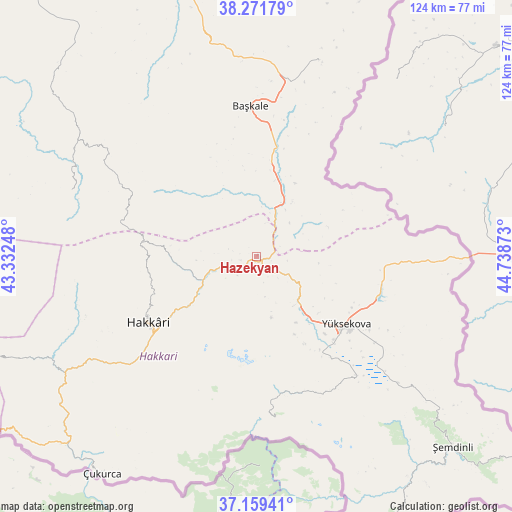
Hazekyan GPS coordinates[2]
37° 43' 3.684" North, 44° 2' 8.16" East
| Map corner | latitude | longitude |
|---|---|---|
| Upper-left | 38.27179°, | 43.33248° |
| Center: | 37.71769°, | 44.0356° |
| Lower-right: | 37.15941°, | 44.73873° |
| Map W x H: | 123.7×123.7 km | = 76.9×76.9mi |
| max Lat: | 42.02683° ⇑70.1% North |
| Hazekyan: | 37.71769° |
| min Lat: | ⇓29.9% South 35.9025° |
| min Long | Hazekyan | max Long |
| 25.90902° | 44.0356° | 44.60099° |
| W 99.5%⇐ | ⇒0.5% E |
Elevation
Elevation of Hazekyan is 1757 m = 5764 ft, and this is 1039.6 m = 3411 ft above average elevation for this country.
| Max E: |
2682 m = 8799 ft | 3.6% |
| Hazekyan | 1757 m 5764 ft | |
| Avg. | 717.4 m = 2354 ft | |
Min E: |
0 m = 0 ft | 96.4% |
See also: Turkey elevation on elevation.city.
Geographical zone
Hazekyan is located in North temperate zone (between Tropic of Cancer and the Arctic Circle). Distance of this Northern Tropic circle is 1587.9 km =986.7 mi to South.| Distance of | km | miles | from Hazekyan |
|---|---|---|---|
| North Pole | 5813.2 | 3612.2 | to North |
| Arctic Circle | 3207.4 | 1993 | to North |
| Tropic Cancer | 1587.9 | 986.7 | to South |
| Equator | 4193.8 | 2605.9 | to South |


Nearby cities:
15 places around Hazekyan: (largest is in red/bold)
• Albayrak
49.4 km =30.7 mi,  17°
17°
• Başkale
36.5 km =22.7 mi,  357°
357°
• Buğdaylı
70.9 km =44.1 mi,  267°
267°
• Dağlıca
39.3 km =24.4 mi,  173°
173°
• Esendere
49.7 km =30.9 mi,  90°
90°
• Geçitli
44.2 km =27.5 mi,  250°
250°
• Güzelsu
69.1 km =42.9 mi,  342°
342°
• Hakkâri
30.4 km =18.9 mi,  238°
238°
• Karsani
68.7 km =42.7 mi,  228°
228°
• Kelitan
61.5 km =38.2 mi, 235°
• Kırkgeçit
66.5 km =41.3 mi,  314°
314°
• Yalınca
47.7 km =29.6 mi,  288°
288°
• Yüksekova
27.3 km =17 mi,  125°
125°
• Çukurca
64.1 km =39.8 mi,  215°
215°
• Şemdinli
66 km =41 mi, 133°
Sources, notices
• [Note1] Compared only with cities in Turkey existing in our database
• [Src1] Map data: © OpenStreetMap contributors (CC-BY-SA)
• [Src2] Other city data from geonames.org with taken over terms of usage.
• [Src3] Geographical zone / Annual Mean Temperature by Robert A. Rohde @ Wikipedia
