Yağmurdere geodata
Yağmurdere (Gümüşhane) is a seat of a third-order administrative division; located in Turkey in Europe/Istanbul (GMT+3) time zone. In our database, there are 1323 cities with bigger population. Compared to other cities in Turkey, 78.7% of cities are located further ↓South; 72.9% of cities are located further ←West and 96.8% of cities have lower elevation than Yağmurdere. Note1


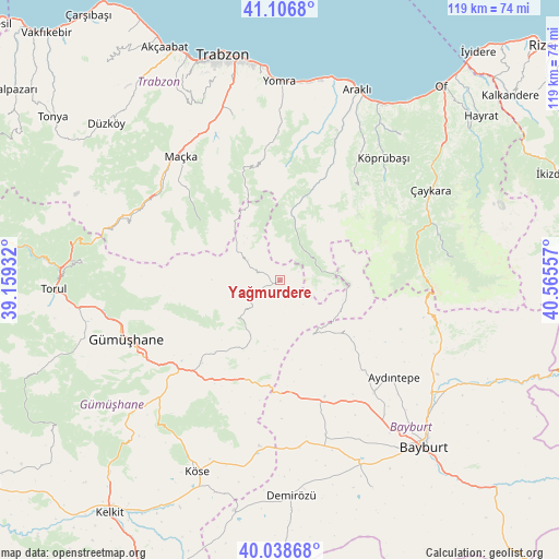
Yağmurdere GPS coordinates[2]
40° 34' 29.532" North, 39° 51' 44.784" East
| Map corner | latitude | longitude |
|---|---|---|
| Upper-left | 41.1068°, | 39.15932° |
| Center: | 40.57487°, | 39.86244° |
| Lower-right: | 40.03868°, | 40.56557° |
| Map W x H: | 118.8×118.8 km | = 73.8×73.8mi |
| max Lat: | 42.02683° ⇑21.3% North |
| Yağmurdere: | 40.57487° |
| min Lat: | ⇓78.7% South 35.9025° |
| min Long | Yağmurdere | max Long |
| 25.90902° | 39.86244° | 44.60099° |
| W 72.9%⇐ | ⇒27.1% E |
Elevation
Elevation of Yağmurdere is 1779 m = 5837 ft, and this is 1061.6 m = 3483 ft above average elevation for this country.
| Max E: |
2682 m = 8799 ft | 3.2% |
| Yağmurdere | 1779 m 5837 ft | |
| Avg. | 717.4 m = 2354 ft | |
Min E: |
0 m = 0 ft | 96.8% |
See also: Turkey elevation on elevation.city.
Geographical zone
Yağmurdere is located in North temperate zone (between Tropic of Cancer and the Arctic Circle). Distance of this Northern Tropic circle is 1905.6 km =1184.1 mi to South.| Distance of | km | miles | from Yağmurdere |
|---|---|---|---|
| North Pole | 5495.6 | 3414.8 | to North |
| Arctic Circle | 2889.7 | 1795.6 | to North |
| Tropic Cancer | 1905.6 | 1184.1 | to South |
| Equator | 4511.5 | 2803.3 | to South |


Nearby cities:
15 places around Yağmurdere: (largest is in red/bold)
• Arsin
42.4 km =26.3 mi,  7°
7°
• Aydıntepe
31.9 km =19.8 mi,  131°
131°
• Dağbaşı
17.5 km =10.9 mi, 13°
• Dernekpazarı
40.6 km =25.2 mi,  52°
52°
• Esiroğlu
36.3 km =22.6 mi,  336°
336°
• Gumushkhane
35.4 km =22 mi,  248°
248°
• Kale
25.8 km =16 mi,  215°
215°
• Köprübaşı
33.4 km =20.8 mi,  39°
39°
• Küçükdere
30.5 km =19 mi,  32°
32°
• Maçka
34.1 km =21.2 mi,  320°
320°
• Uzungöl
36.3 km =22.6 mi,  82°
82°
• Yağlıdere
28.5 km =17.7 mi,  263°
263°
• Yomra
42.1 km =26.2 mi,  359°
359°
• Çaykara
36.3 km =22.6 mi,  59°
59°
• Çağlayan
38.3 km =23.8 mi, 340°
Sources, notices
• [Note1] Compared only with cities in Turkey existing in our database
• [Src1] Map data: © OpenStreetMap contributors (CC-BY-SA)
• [Src2] Other city data from geonames.org with taken over terms of usage.
• [Src3] Geographical zone / Annual Mean Temperature by Robert A. Rohde @ Wikipedia
