Taflan geodata
Taflan (Samsun) is a seat of a third-order administrative division; located in Turkey in Europe/Istanbul (GMT+3) time zone. In our database, there are 1323 cities with bigger population. Compared to other cities in Turkey, 96.5% of cities are located further ↓South; 51.3% of cities are located further ←West and 75.7% of cities have higher elevation than Taflan. Note1


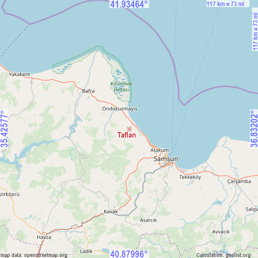
Taflan GPS coordinates[2]
41° 24' 33.984" North, 36° 7' 44.004" East
| Map corner | latitude | longitude |
|---|---|---|
| Upper-left | 41.93464°, | 35.42577° |
| Center: | 41.40944°, | 36.12889° |
| Lower-right: | 40.87996°, | 36.83202° |
| Map W x H: | 117.3×117.3 km | = 72.9×72.9mi |
| max Lat: | 42.02683° ⇑3.5% North |
| Taflan: | 41.40944° |
| min Lat: | ⇓96.5% South 35.9025° |
| min Long | Taflan | max Long |
| 25.90902° | 36.12889° | 44.60099° |
| W 51.3%⇐ | ⇒48.7% E |
Elevation
Elevation of Taflan is 166 m = 545 ft, and this is 551.4 m = 1809 ft below average elevation for this country.
| Max E: |
2682 m = 8799 ft | 75.7% |
| Avg. | 717.4 m = 2354 ft | |
| Taflan | 166 m = 545 ft | |
Min E: |
0 m = 0 ft | 24.3% |
See also: Turkey elevation on elevation.city.
Geographical zone
Taflan is located in North temperate zone (between Tropic of Cancer and the Arctic Circle). Distance of this Northern Tropic circle is 1998.4 km =1241.7 mi to South.| Distance of | km | miles | from Taflan |
|---|---|---|---|
| North Pole | 5402.8 | 3357.1 | to North |
| Arctic Circle | 2796.9 | 1737.9 | to North |
| Tropic Cancer | 1998.4 | 1241.7 | to South |
| Equator | 4604.3 | 2861 | to South |


Nearby cities:
15 places around Taflan: (largest is in red/bold)
• Alaçam
49.3 km =30.6 mi,  296°
296°
• Asarcık
42.5 km =26.4 mi,  167°
167°
• Bafra
25.5 km =15.8 mi,  313°
313°
• Boğazkaya
22.3 km =13.9 mi,  281°
281°
• Dikbıyık
45.7 km =28.4 mi,  117°
117°
• Kavak
37.5 km =23.3 mi,  191°
191°
• Kolay
27.3 km =17 mi,  272°
272°
• Ondokuzmayıs
11.4 km =7.1 mi,  333°
333°
• Samsun
22.5 km =14 mi,  129°
129°
• Tekkeköy
35.3 km =21.9 mi, 128°
• Çakıralan
40.8 km =25.4 mi,  228°
228°
• Çarşamba
54.8 km =34.1 mi, 115°
• Çayırkent
31.3 km =19.4 mi,  147°
147°
• İlkadım
19.1 km =11.9 mi,  135°
135°
• Şeyhli
54.5 km =33.9 mi, 185°
Sources, notices
• [Note1] Compared only with cities in Turkey existing in our database
• [Src1] Map data: © OpenStreetMap contributors (CC-BY-SA)
• [Src2] Other city data from geonames.org with taken over terms of usage.
• [Src3] Geographical zone / Annual Mean Temperature by Robert A. Rohde @ Wikipedia
