Bafra geodata
Bafra (Samsun) is a seat of a second-order administrative division; located in Turkey in Europe/Istanbul (GMT+3) time zone. With population of 92,944 people, there are 90 cities with bigger population in this country. Compared to other cities in Turkey, 97.9% of cities are located further ↓South; 50.2% of cities are located further →East and 92.2% of cities have higher elevation than Bafra. Note1


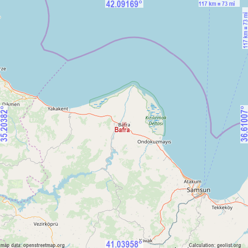
Bafra GPS coordinates[2]
41° 34' 4.008" North, 35° 54' 24.984" East
| Map corner | latitude | longitude |
|---|---|---|
| Upper-left | 42.09169°, | 35.20382° |
| Center: | 41.56778°, | 35.90694° |
| Lower-right: | 41.03958°, | 36.61007° |
| Map W x H: | 117×117 km | = 72.7×72.7mi |
| max Lat: | 42.02683° ⇑2.1% North |
| Bafra: | 41.56778° |
| min Lat: | ⇓97.9% South 35.9025° |
| min Long | Bafra | max Long |
| 25.90902° | 35.90694° | 44.60099° |
| W 49.8%⇐ | ⇒50.2% E |
Elevation
Elevation of Bafra is 28 m = 92 ft, and this is 689.4 m = 2262 ft below average elevation for this country.
| Max E: |
2682 m = 8799 ft | 92.2% |
| Avg. | 717.4 m = 2354 ft | |
| Bafra | 28 m = 92 ft | |
Min E: |
0 m = 0 ft | 7.8% |
See also: Bafra elevation on elevation.city.
Geographical zone
Bafra is located in North temperate zone (between Tropic of Cancer and the Arctic Circle). Distance of this Northern Tropic circle is 2016 km =1252.7 mi to South.| Distance of | km | miles | from Bafra |
|---|---|---|---|
| North Pole | 5385.2 | 3346.2 | to North |
| Arctic Circle | 2779.3 | 1727 | to North |
| Tropic Cancer | 2016 | 1252.7 | to South |
| Equator | 4621.9 | 2871.9 | to South |


Nearby cities:
15 places around Bafra: (largest is in red/bold)
• Alaçam
26 km =16.2 mi,  279°
279°
• Boğazkaya
13.5 km =8.4 mi,  194°
194°
• Dikmen
54 km =33.6 mi, 279°
• Kavak
55.6 km =34.5 mi,  168°
168°
• Kolay
18.8 km =11.7 mi,  207°
207°
• Ondokuzmayıs
15.4 km =9.6 mi,  118°
118°
• Samsun
48 km =29.8 mi,  131°
131°
• Taflan
25.5 km =15.8 mi, 133°
• Tekkeköy
60.8 km =37.8 mi, 130°
• Vezirköprü
60.4 km =37.5 mi,  218°
218°
• Yakakent
32.2 km =20 mi, 282°
• Çakıralan
46.1 km =28.6 mi,  195°
195°
• Çayırkent
56.4 km =35 mi,  141°
141°
• Çerçiler
59.1 km =36.7 mi,  250°
250°
• İlkadım
44.7 km =27.8 mi, 134°
Sources, notices
• [Note1] Compared only with cities in Turkey existing in our database
• [Src1] Map data: © OpenStreetMap contributors (CC-BY-SA)
• [Src2] Other city data from geonames.org with taken over terms of usage.
• [Src3] Geographical zone / Annual Mean Temperature by Robert A. Rohde @ Wikipedia
