Kozlu geodata
Kozlu (Tokat) is a seat of a third-order administrative division; located in Turkey in Europe/Istanbul (GMT+3) time zone. In our database, there are 1323 cities with bigger population. Compared to other cities in Turkey, 79.2% of cities are located further ↓South; 54.6% of cities are located further ←West and 62.9% of cities have lower elevation than Kozlu. Note1


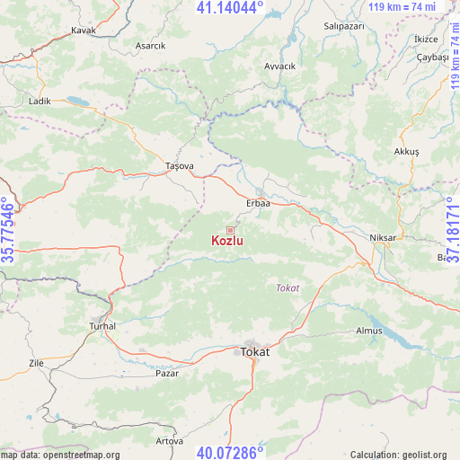
Kozlu GPS coordinates[2]
40° 36' 31.608" North, 36° 28' 42.888" East
| Map corner | latitude | longitude |
|---|---|---|
| Upper-left | 41.14044°, | 35.77546° |
| Center: | 40.60878°, | 36.47858° |
| Lower-right: | 40.07286°, | 37.18171° |
| Map W x H: | 118.7×118.7 km | = 73.8×73.8mi |
| max Lat: | 42.02683° ⇑20.8% North |
| Kozlu: | 40.60878° |
| min Lat: | ⇓79.2% South 35.9025° |
| min Long | Kozlu | max Long |
| 25.90902° | 36.47858° | 44.60099° |
| W 54.6%⇐ | ⇒45.4% E |
Elevation
Elevation of Kozlu is 928 m = 3045 ft, and this is 210.6 m = 691 ft above average elevation for this country.
| Max E: |
2682 m = 8799 ft | 37.1% |
| Kozlu | 928 m 3045 ft | |
| Avg. | 717.4 m = 2354 ft | |
Min E: |
0 m = 0 ft | 62.9% |
See also: Turkey elevation on elevation.city.
Geographical zone
Kozlu is located in North temperate zone (between Tropic of Cancer and the Arctic Circle). Distance of this Northern Tropic circle is 1909.4 km =1186.4 mi to South.| Distance of | km | miles | from Kozlu |
|---|---|---|---|
| North Pole | 5491.8 | 3412.4 | to North |
| Arctic Circle | 2885.9 | 1793.2 | to North |
| Tropic Cancer | 1909.4 | 1186.4 | to South |
| Equator | 4515.3 | 2805.7 | to South |


Nearby cities:
15 places around Kozlu: (largest is in red/bold)
• Destek
36.3 km =22.6 mi,  316°
316°
• Doğanyurt
21.9 km =13.6 mi,  66°
66°
• Dökmetepe
36.6 km =22.7 mi,  205°
205°
• Erbaa
10 km =6.2 mi,  48°
48°
• Esençay
10.6 km =6.6 mi,  308°
308°
• Ezinepazarı
29 km =18 mi,  261°
261°
• Gökdere
27.6 km =17.1 mi,  123°
123°
• Gökçeli
21.7 km =13.5 mi,  97°
97°
• Karayaka
17.7 km =11 mi,  32°
32°
• Niksar
40 km =24.9 mi,  92°
92°
• Pazar
40.5 km =25.2 mi,  204°
204°
• Taşova
21.3 km =13.2 mi, 321°
• Tekke
26.9 km =16.7 mi,  296°
296°
• Tokat
33.4 km =20.8 mi,  168°
168°
• Yeşilyurt
33 km =20.5 mi, 198°
Sources, notices
• [Note1] Compared only with cities in Turkey existing in our database
• [Src1] Map data: © OpenStreetMap contributors (CC-BY-SA)
• [Src2] Other city data from geonames.org with taken over terms of usage.
• [Src3] Geographical zone / Annual Mean Temperature by Robert A. Rohde @ Wikipedia
