Rujewa geodata
Rujewa (Mbeya) is a populated place; located in Tanzania in Africa/Dar_es_Salaam (GMT+3) time zone. With population of 29,228 people, there are 65 cities with bigger population in this country. Compared to other cities in Tanzania, 77.6% of cities are located further ↑North; 60.1% of cities are located further →East and 55.2% of cities have higher elevation than Rujewa. Note1


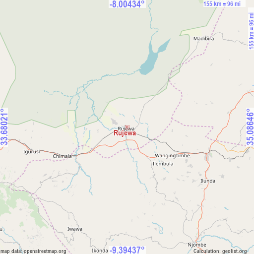
Rujewa GPS coordinates[2]
8° 42' 0" South, 34° 22' 59.988" East
| Map corner | latitude | longitude |
|---|---|---|
| Upper-left | -8.00434°, | 33.68021° |
| Center: | -8.7°, | 34.38333° |
| Lower-right: | -9.39437°, | 35.08646° |
| Map W x H: | 154.6×154.6 km | = 96.1×96.1mi |
| max Lat: | -1.14389° ⇑77.6% North |
| Rujewa: | -8.7° |
| min Lat: | ⇓22.4% South -11.36667° |
| min Long | Rujewa | max Long |
| 29.62667° | 34.38333° | 40.33333° |
| W 39.9%⇐ | ⇒60.1% E |
Elevation
Elevation of Rujewa is 1078 m = 3537 ft, and this is 135.2 m = 444 ft above average elevation for this country.
| Max E: |
2377 m = 7799 ft | 55.2% |
| Rujewa | 1078 m 3537 ft | |
| Avg. | 942.8 m = 3093 ft | |
Min E: |
0 m = 0 ft | 44.8% |
See also: Tanzania elevation on elevation.city.
Geographical zone
Rujewa is located in South Torrid zone (between Equator and Tropic of Capricorn). Distance of Equator is 967.3 km =601.1 mi to North.| Distance of | km | miles | from Rujewa |
|---|---|---|---|
| Equator | 967.3 | 601.1 | to North |
| Tropic Capricorn | 1638.6 | 1018.2 | to South |
| Antarctic Circle | 6433.8 | 3997.8 | to South |
| South Pole | 9039.7 | 5617 | to South |


Nearby cities:
15 places around Rujewa: (largest is in red/bold)
• Chimala
43.2 km =26.8 mi,  246°
246°
• Dunda
66.5 km =41.3 mi,  347°
347°
• Igurusi
60.9 km =37.8 mi, 254°
• Ilembula
31.3 km =19.4 mi,  135°
135°
• Ipinda
102 km =63.4 mi,  211°
211°
• Kandete
81.3 km =50.5 mi,  232°
232°
• Makumbako
52.2 km =32.4 mi,  108°
108°
• Makungu
99 km =61.5 mi,  92°
92°
• Malangali
53.4 km =33.2 mi,  73°
73°
• Masoko
99 km =61.5 mi,  224°
224°
• Matamba
55.6 km =34.5 mi,  235°
235°
• Mtwango
57.8 km =35.9 mi,  127°
127°
• Njombe
83.8 km =52.1 mi,  149°
149°
• Tukuyu
101.1 km =62.8 mi, 232°
• Ulenje
81.2 km =50.5 mi, 251°
Sources, notices
• [Note1] Compared only with cities in Tanzania existing in our database
• [Src1] Map data: © OpenStreetMap contributors (CC-BY-SA)
• [Src2] Other city data from geonames.org with taken over terms of usage.
• [Src3] Geographical zone / Annual Mean Temperature by Robert A. Rohde @ Wikipedia
