Slavutych geodata
Slavutych (Kyiv) is a populated place; located in Ukraine in Europe/Kiev (GMT+3) time zone. With population of 25,000 people, there are 166 cities with bigger population in this country. Compared to other cities in Ukraine, 98.1% of cities are located further ↓South; 63.4% of cities are located further →East and 50.8% of cities have higher elevation than Slavutych. Note1


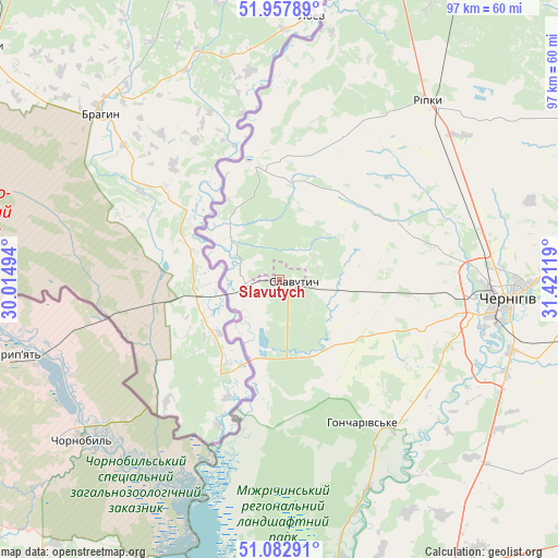
Slavutych GPS coordinates[2]
51° 31' 21" North, 30° 43' 5.016" East
| Map corner | latitude | longitude |
|---|---|---|
| Upper-left | 51.95789°, | 30.01494° |
| Center: | 51.5225°, | 30.71806° |
| Lower-right: | 51.08291°, | 31.42119° |
| Map W x H: | 97.3×97.3 km | = 60.5×60.5mi |
| max Lat: | 52.18903° ⇑1.9% North |
| Slavutych: | 51.5225° |
| min Lat: | ⇓98.1% South 44.39214° |
| min Long | Slavutych | max Long |
| 22.20555° | 30.71806° | 40.13222° |
| W 36.6%⇐ | ⇒63.4% E |
Elevation
Elevation of Slavutych is 131 m = 430 ft, and this is 24.8 m = 81 ft below average elevation for this country.
| Max E: |
886 m = 2907 ft | 50.8% |
| Avg. | 155.8 m = 511 ft | |
| Slavutych | 131 m = 430 ft | |
Min E: |
-3 m = -10 ft | 49.2% |
See also: Ukraine elevation on elevation.city.
Geographical zone
Slavutych is located in North temperate zone (between Tropic of Cancer and the Arctic Circle). Distance of this North polar circle is 1672.4 km =1039.2 mi to North.| Distance of | km | miles | from Slavutych |
|---|---|---|---|
| North Pole | 4278.3 | 2658.4 | to North |
| Arctic Circle | 1672.4 | 1039.2 | to North |
| Tropic Cancer | 3122.8 | 1940.4 | to South |
| Equator | 5728.8 | 3559.7 | to South |


Nearby cities:
15 places around Slavutych: (largest is in red/bold)
• Berezna
73.9 km =45.9 mi,  85°
85°
• Chernihiv
39.3 km =24.4 mi, 92°
• Desna
66.2 km =41.1 mi,  177°
177°
• Dobryanka
68.2 km =42.4 mi,  28°
28°
• Horodnya
73.1 km =45.4 mi,  55°
55°
• Ivankiv
86.6 km =53.8 mi,  221°
221°
• Kozelets’
73.3 km =45.5 mi,  157°
157°
• Kryva Hora
39 km =24.2 mi,  246°
246°
• Kulykivka
66.4 km =41.3 mi,  104°
104°
• Lyubech
20.5 km =12.7 mi,  348°
348°
• Novi Yarylovychi
59.8 km =37.2 mi,  19°
19°
• Olyshivka
54.2 km =33.7 mi,  127°
127°
• Oster
64.6 km =40.1 mi,  169°
169°
• Ripky
39.9 km =24.8 mi,  39°
39°
• Sedniv
60.1 km =37.3 mi,  76°
76°
In other languages:
- In France: Slavoutytch
- In German: Slawutytsch
- In Italian: Slavutyč
- In Russian: Славутич
- In Chinese: 斯拉夫蒂奇
Sources, notices
• [Note1] Compared only with cities in Ukraine existing in our database
• [Src1] Map data: © OpenStreetMap contributors (CC-BY-SA)
• [Src2] Other city data from geonames.org with taken over terms of usage.
• [Src3] Geographical zone / Annual Mean Temperature by Robert A. Rohde @ Wikipedia
