Kryva Hora geodata
Kryva Hora (Kyiv) is a abandoned populated place; located in Ukraine in Europe/Kiev (GMT+3) time zone. With population of 3,461 people, there are 840 cities with bigger population in this country. Compared to other cities in Ukraine, 97.6% of cities are located further ↓South; 66.7% of cities are located further →East and 58.8% of cities have higher elevation than Kryva Hora. Note1


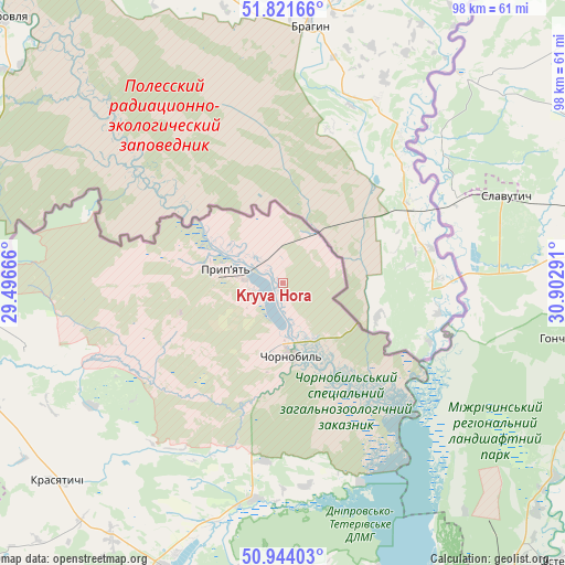
Kryva Hora GPS coordinates[2]
51° 23' 5.82" North, 30° 11' 59.208" East
| Map corner | latitude | longitude |
|---|---|---|
| Upper-left | 51.82166°, | 29.49666° |
| Center: | 51.38495°, | 30.19978° |
| Lower-right: | 50.94403°, | 30.90291° |
| Map W x H: | 97.6×97.6 km | = 60.6×60.6mi |
| max Lat: | 52.18903° ⇑2.4% North |
| Kryva Hora: | 51.38495° |
| min Lat: | ⇓97.6% South 44.39214° |
| min Long | Kryva Hora | max Long |
| 22.20555° | 30.19978° | 40.13222° |
| W 33.3%⇐ | ⇒66.7% E |
Elevation
Elevation of Kryva Hora is 109 m = 358 ft, and this is 46.8 m = 154 ft below average elevation for this country.
| Max E: |
886 m = 2907 ft | 58.8% |
| Avg. | 155.8 m = 511 ft | |
| Kryva Hora | 109 m = 358 ft | |
Min E: |
-3 m = -10 ft | 41.2% |
See also: Ukraine elevation on elevation.city.
Geographical zone
Kryva Hora is located in North temperate zone (between Tropic of Cancer and the Arctic Circle). Distance of this North polar circle is 1687.7 km =1048.7 mi to North.| Distance of | km | miles | from Kryva Hora |
|---|---|---|---|
| North Pole | 4293.6 | 2667.9 | to North |
| Arctic Circle | 1687.7 | 1048.7 | to North |
| Tropic Cancer | 3107.6 | 1931 | to South |
| Equator | 5713.5 | 3550.2 | to South |


Nearby cities:
15 places around Kryva Hora: (largest is in red/bold)
• Borodianka
84.6 km =52.6 mi,  193°
193°
• Chernihiv
76.4 km =47.5 mi,  79°
79°
• Desna
64.2 km =39.9 mi,  142°
142°
• Dymer
66.9 km =41.6 mi,  173°
173°
• Ivankiv
54 km =33.6 mi,  203°
203°
• Katyuzhanka
64.5 km =40.1 mi,  183°
183°
• Kozelets’
83 km =51.6 mi,  129°
129°
• Krasyatychi
51.5 km =32 mi,  228°
228°
• Liutizh
79.2 km =49.2 mi, 170°
• Lyubech
47.4 km =29.5 mi,  41°
41°
• Narodychi
80.3 km =49.9 mi,  255°
255°
• Olyshivka
80.8 km =50.2 mi,  102°
102°
• Oster
67.8 km =42.1 mi, 135°
• Ripky
76.6 km =47.6 mi,  52°
52°
• Slavutych
39 km =24.2 mi,  66°
66°
Sources, notices
• [Note1] Compared only with cities in Ukraine existing in our database
• [Src1] Map data: © OpenStreetMap contributors (CC-BY-SA)
• [Src2] Other city data from geonames.org with taken over terms of usage.
• [Src3] Geographical zone / Annual Mean Temperature by Robert A. Rohde @ Wikipedia
