Ripky geodata
Ripky (Chernihiv) is a seat of a second-order administrative division; located in Ukraine in Europe/Kiev (GMT+3) time zone. With population of 7,708 people, there are 466 cities with bigger population in this country. Compared to other cities in Ukraine, 99.3% of cities are located further ↓South; 60.8% of cities are located further →East and 53% of cities have lower elevation than Ripky. Note1


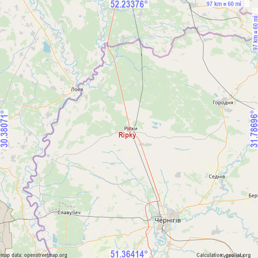
Ripky GPS coordinates[2]
51° 48' 3.78" North, 31° 5' 1.788" East
| Map corner | latitude | longitude |
|---|---|---|
| Upper-left | 52.23376°, | 30.38071° |
| Center: | 51.80105°, | 31.08383° |
| Lower-right: | 51.36414°, | 31.78696° |
| Map W x H: | 96.7×96.7 km | = 60.1×60.1mi |
| max Lat: | 52.18903° ⇑0.7% North |
| Ripky: | 51.80105° |
| min Lat: | ⇓99.3% South 44.39214° |
| min Long | Ripky | max Long |
| 22.20555° | 31.08383° | 40.13222° |
| W 39.2%⇐ | ⇒60.8% E |
Elevation
Elevation of Ripky is 145 m = 476 ft, and this is 10.8 m = 35 ft below average elevation for this country.
| Max E: |
886 m = 2907 ft | 47% |
| Avg. | 155.8 m = 511 ft | |
| Ripky | 145 m = 476 ft | |
Min E: |
-3 m = -10 ft | 53% |
See also: Ukraine elevation on elevation.city.
Geographical zone
Ripky is located in North temperate zone (between Tropic of Cancer and the Arctic Circle). Distance of this North polar circle is 1641.4 km =1019.9 mi to North.| Distance of | km | miles | from Ripky |
|---|---|---|---|
| North Pole | 4247.3 | 2639.1 | to North |
| Arctic Circle | 1641.4 | 1019.9 | to North |
| Tropic Cancer | 3153.8 | 1959.7 | to South |
| Equator | 5759.7 | 3578.9 | to South |


Nearby cities:
15 places around Ripky: (largest is in red/bold)
• Berezna
54.6 km =33.9 mi,  117°
117°
• Chernihiv
35.7 km =22.2 mi,  157°
157°
• Dobryanka
30 km =18.6 mi,  13°
13°
• Horodnya
36.7 km =22.8 mi,  74°
74°
• Koryukivka
80.2 km =49.8 mi,  92°
92°
• Kryva Hora
76.6 km =47.6 mi,  232°
232°
• Kulykivka
61.4 km =38.2 mi,  140°
140°
• Lyubech
31.4 km =19.5 mi,  249°
249°
• Mena
84 km =52.2 mi,  111°
111°
• Novi Yarylovychi
26 km =16.2 mi,  348°
348°
• Olyshivka
66.6 km =41.4 mi, 164°
• Oster
95.6 km =59.4 mi,  188°
188°
• Sedniv
37.4 km =23.2 mi, 117°
• Shchors
59.2 km =36.8 mi, 88°
• Slavutych
39.9 km =24.8 mi,  219°
219°
Sources, notices
• [Note1] Compared only with cities in Ukraine existing in our database
• [Src1] Map data: © OpenStreetMap contributors (CC-BY-SA)
• [Src2] Other city data from geonames.org with taken over terms of usage.
• [Src3] Geographical zone / Annual Mean Temperature by Robert A. Rohde @ Wikipedia
