Chernihiv geodata
Chernihiv is a seat of a first-order administrative division; located in Ukraine in Europe/Kiev (GMT+3) time zone. With population of 307,684 people, there are 18 cities with bigger population in this country. Compared to other cities in Ukraine, 98% of cities are located further ↓South; 60% of cities are located further →East and 52.2% of cities have higher elevation than Chernihiv. Note1


Chernihiv GPS coordinates[2]
51° 30' 19.836" North, 31° 17' 5.532" East
| Map corner | latitude | longitude |
|---|---|---|
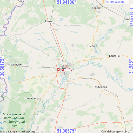
| Upper-left | 51.94106°, | 30.58175° |
| Center: | 51.50551°, | 31.28487° |
| Lower-right: | 51.06575°, | 31.988° |
| Map W x H: | 97.3×97.3 km | = 60.5×60.5mi |
| max Lat: | 52.18903° ⇑2% North |
| Chernihiv: | 51.50551° |
| min Lat: | ⇓98% South 44.39214° |
| min Long | Chernihiv | max Long |
| 22.20555° | 31.28487° | 40.13222° |
| W 40%⇐ | ⇒60% E |
Elevation
Elevation of Chernihiv is 127 m = 417 ft, and this is 28.8 m = 94 ft below average elevation for this country.
| Max E: |
886 m = 2907 ft | 52.2% |
| Avg. | 155.8 m = 511 ft | |
| Chernihiv | 127 m = 417 ft | |
Min E: |
-3 m = -10 ft | 47.8% |
See also: Chernihiv elevation on elevation.city.
Geographical zone
Chernihiv is located in North temperate zone (between Tropic of Cancer and the Arctic Circle). Distance of this North polar circle is 1674.3 km =1040.4 mi to North.| Distance of | km | miles | from Chernihiv |
|---|---|---|---|
| North Pole | 4280.2 | 2659.6 | to North |
| Arctic Circle | 1674.3 | 1040.4 | to North |
| Tropic Cancer | 3121 | 1939.3 | to South |
| Equator | 5726.9 | 3558.5 | to South |


Nearby cities:
15 places around Chernihiv: (largest is in red/bold)
• Berezna
35.3 km =21.9 mi,  77°
77°
• Dobryanka
62.4 km =38.8 mi,  353°
353°
• Horodnya
48 km =29.8 mi,  26°
26°
• Kozelets’
66.8 km =41.5 mi,  189°
189°
• Kulykivka
29.1 km =18.1 mi,  120°
120°
• Lyubech
48.6 km =30.2 mi,  296°
296°
• Mena
64.4 km =40 mi,  88°
88°
• Nizhyn
65.9 km =40.9 mi,  140°
140°
• Nosivka
67.1 km =41.7 mi,  161°
161°
• Novi Yarylovychi
61.4 km =38.2 mi,  341°
341°
• Olyshivka
31.6 km =19.6 mi,  173°
173°
• Ripky
35.7 km =22.2 mi, 337°
• Sedniv
24.8 km =15.4 mi,  51°
51°
• Shchors
57.3 km =35.6 mi, 52°
• Slavutych
39.3 km =24.4 mi,  272°
272°
In other languages:
- In Spanish: Chernígov
- In France: Tchernihiv
- In German: Tschernihiw
- In Italian: Černihiv
- In Russian: Чернигов
- In Chinese: 切尔尼戈夫
Sources, notices
• [Note1] Compared only with cities in Ukraine existing in our database
• [Src1] Map data: © OpenStreetMap contributors (CC-BY-SA)
• [Src2] Other city data from geonames.org with taken over terms of usage.
• [Src3] Geographical zone / Annual Mean Temperature by Robert A. Rohde @ Wikipedia
