Mashivka geodata
Mashivka (Poltava) is a seat of a second-order administrative division; located in Ukraine in Europe/Kiev (GMT+3) time zone. With population of 3,999 people, there are 764 cities with bigger population in this country. Compared to other cities in Ukraine, 73.9% of cities are located further ↓South; 78.6% of cities are located further ←West and 62.7% of cities have higher elevation than Mashivka. Note1


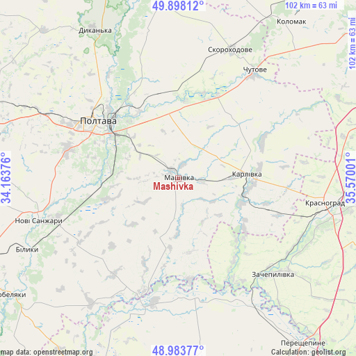
Mashivka GPS coordinates[2]
49° 26' 35.088" North, 34° 52' 0.768" East
| Map corner | latitude | longitude |
|---|---|---|
| Upper-left | 49.89812°, | 34.16376° |
| Center: | 49.44308°, | 34.86688° |
| Lower-right: | 48.98377°, | 35.57001° |
| Map W x H: | 101.7×101.7 km | = 63.2×63.2mi |
| max Lat: | 52.18903° ⇑26.1% North |
| Mashivka: | 49.44308° |
| min Lat: | ⇓73.9% South 44.39214° |
| min Long | Mashivka | max Long |
| 22.20555° | 34.86688° | 40.13222° |
| W 78.6%⇐ | ⇒21.4% E |
Elevation
Elevation of Mashivka is 98 m = 322 ft, and this is 57.8 m = 190 ft below average elevation for this country.
| Max E: |
886 m = 2907 ft | 62.7% |
| Avg. | 155.8 m = 511 ft | |
| Mashivka | 98 m = 322 ft | |
Min E: |
-3 m = -10 ft | 37.3% |
See also: Ukraine elevation on elevation.city.
Geographical zone
Mashivka is located in North temperate zone (between Tropic of Cancer and the Arctic Circle). Distance of this North polar circle is 1903.6 km =1182.8 mi to North.| Distance of | km | miles | from Mashivka |
|---|---|---|---|
| North Pole | 4509.5 | 2802.1 | to North |
| Arctic Circle | 1903.6 | 1182.8 | to North |
| Tropic Cancer | 2891.6 | 1796.8 | to South |
| Equator | 5497.6 | 3416 | to South |


Nearby cities:
15 places around Mashivka: (largest is in red/bold)
• Chutove
36.7 km =22.8 mi,  35°
35°
• Dykan’ka
49 km =30.4 mi,  330°
330°
• Hupalivka
38.1 km =23.7 mi,  194°
194°
• Karlivka
19.1 km =11.9 mi,  85°
85°
• Kobelyaky
58.6 km =36.4 mi,  236°
236°
• Kolomak
54.2 km =33.7 mi, 35°
• Krasnohrad
42.2 km =26.2 mi,  99°
99°
• Mahdalynivka
58.1 km =36.1 mi,  176°
176°
• Novi Sanzhary
41.7 km =25.9 mi,  254°
254°
• Oposhnya
60 km =37.3 mi,  342°
342°
• Poltava
28.9 km =18 mi,  305°
305°
• Reshetylivka
58.5 km =36.4 mi,  283°
283°
• Varvarivka
26.3 km =16.3 mi,  66°
66°
• Verbivka
48.3 km =30 mi, 93°
• Zachepylivka
38.7 km =24 mi,  135°
135°
Sources, notices
• [Note1] Compared only with cities in Ukraine existing in our database
• [Src1] Map data: © OpenStreetMap contributors (CC-BY-SA)
• [Src2] Other city data from geonames.org with taken over terms of usage.
• [Src3] Geographical zone / Annual Mean Temperature by Robert A. Rohde @ Wikipedia
