Korostyshiv geodata
Korostyshiv (Zhytomyr) is a seat of a second-order administrative division; located in Ukraine in Europe/Kiev (GMT+3) time zone. With population of 25,099 people, there are 165 cities with bigger population in this country. Compared to other cities in Ukraine, 88.2% of cities are located further ↓South; 72.4% of cities are located further →East and 63.1% of cities have lower elevation than Korostyshiv. Note1
Administrative division(s):
- Level 1: Zhytomyr
- Level 2: Radomyshl Raion
- Level 3: Korostyshiv Urban AmalgametedTerritorial Community
- Level 4: Korostyshiv Municipality


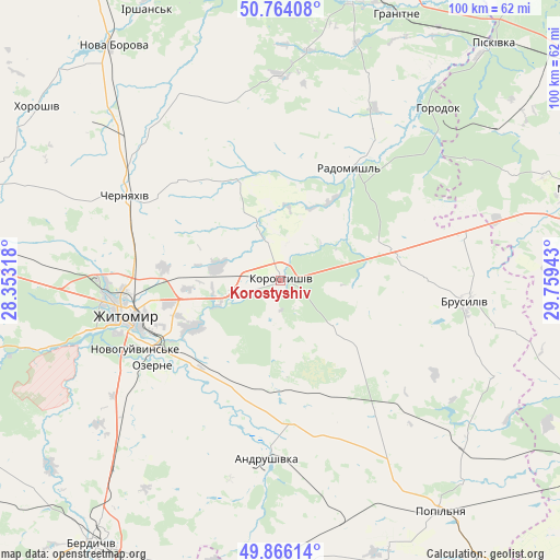
Korostyshiv GPS coordinates[2]
50° 19' 2.028" North, 29° 3' 22.68" East
| Map corner | latitude | longitude |
|---|---|---|
| Upper-left | 50.76408°, | 28.35318° |
| Center: | 50.31723°, | 29.0563° |
| Lower-right: | 49.86614°, | 29.75943° |
| Map W x H: | 99.8×99.8 km | = 62×62mi |
| max Lat: | 52.18903° ⇑11.8% North |
| Korostyshiv: | 50.31723° |
| min Lat: | ⇓88.2% South 44.39214° |
| min Long | Korostyshiv | max Long |
| 22.20555° | 29.0563° | 40.13222° |
| W 27.6%⇐ | ⇒72.4% E |
Elevation
Elevation of Korostyshiv is 180 m = 591 ft, and this is 24.2 m = 79 ft above average elevation for this country.
| Max E: |
886 m = 2907 ft | 36.9% |
| Korostyshiv | 180 m 591 ft | |
| Avg. | 155.8 m = 511 ft | |
Min E: |
-3 m = -10 ft | 63.1% |
See also: Ukraine elevation on elevation.city.
Geographical zone
Korostyshiv is located in North temperate zone (between Tropic of Cancer and the Arctic Circle). Distance of this North polar circle is 1806.4 km =1122.4 mi to North.| Distance of | km | miles | from Korostyshiv |
|---|---|---|---|
| North Pole | 4412.3 | 2741.7 | to North |
| Arctic Circle | 1806.4 | 1122.4 | to North |
| Tropic Cancer | 2988.8 | 1857.2 | to South |
| Equator | 5594.8 | 3476.4 | to South |


Nearby cities:
15 places around Korostyshiv: (largest is in red/bold)
• Andrushivka
32.8 km =20.4 mi,  184°
184°
• Bila Krynytsya
46.3 km =28.8 mi,  39°
39°
• Brovky Pershi
44 km =27.3 mi,  166°
166°
• Brusyliv
33.6 km =20.9 mi,  96°
96°
• Cherniakhiv
31.5 km =19.6 mi,  299°
299°
• Chervone
43 km =26.7 mi,  198°
198°
• Denyshi
47.8 km =29.7 mi,  256°
256°
• Holovyne
23.7 km =14.7 mi,  316°
316°
• Horodok
42.1 km =26.2 mi, 42°
• Kodra
47.1 km =29.3 mi,  49°
49°
• Kornyn
42.1 km =26.2 mi,  125°
125°
• Ozerne
27.7 km =17.2 mi,  236°
236°
• Radomyshl
23.4 km =14.5 mi,  31°
31°
• Stavyshche
34.7 km =21.6 mi,  74°
74°
• Zhytomyr
27.6 km =17.1 mi, 257°
In other languages:
- In France: Korostychiv
- In German: Korostyschiw
- In Russian: Korostyshev, Коростышев, Korostyschew, Korostychev
- In Chinese: 科羅斯特希夫
Sources, notices
• [Note1] Compared only with cities in Ukraine existing in our database
• [Src1] Map data: © OpenStreetMap contributors (CC-BY-SA)
• [Src2] Other city data from geonames.org with taken over terms of usage.
• [Src3] Geographical zone / Annual Mean Temperature by Robert A. Rohde @ Wikipedia
