Radomyshl geodata
Radomyshl (Zhytomyr) is a seat of a second-order administrative division; located in Ukraine in Europe/Kiev (GMT+3) time zone. With population of 15,252 people, there are 253 cities with bigger population in this country. Compared to other cities in Ukraine, 90.9% of cities are located further ↓South; 71.6% of cities are located further →East and 58.5% of cities have lower elevation than Radomyshl. Note1


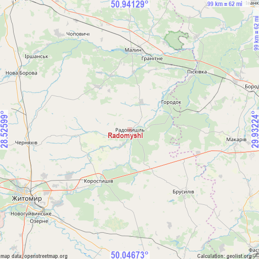
Radomyshl GPS coordinates[2]
50° 29' 46.068" North, 29° 13' 44.796" East
| Map corner | latitude | longitude |
|---|---|---|
| Upper-left | 50.94129°, | 28.52599° |
| Center: | 50.49613°, | 29.22911° |
| Lower-right: | 50.04673°, | 29.93224° |
| Map W x H: | 99.5×99.5 km | = 61.8×61.8mi |
| max Lat: | 52.18903° ⇑9.1% North |
| Radomyshl: | 50.49613° |
| min Lat: | ⇓90.9% South 44.39214° |
| min Long | Radomyshl | max Long |
| 22.20555° | 29.22911° | 40.13222° |
| W 28.4%⇐ | ⇒71.6% E |
Elevation
Elevation of Radomyshl is 163 m = 535 ft, and this is 7.2 m = 24 ft above average elevation for this country.
| Max E: |
886 m = 2907 ft | 41.5% |
| Radomyshl | 163 m 535 ft | |
| Avg. | 155.8 m = 511 ft | |
Min E: |
-3 m = -10 ft | 58.5% |
See also: Ukraine elevation on elevation.city.
Geographical zone
Radomyshl is located in North temperate zone (between Tropic of Cancer and the Arctic Circle). Distance of this North polar circle is 1786.5 km =1110.1 mi to North.| Distance of | km | miles | from Radomyshl |
|---|---|---|---|
| North Pole | 4392.4 | 2729.3 | to North |
| Arctic Circle | 1786.5 | 1110.1 | to North |
| Tropic Cancer | 3008.7 | 1869.5 | to South |
| Equator | 5614.6 | 3488.7 | to South |


Nearby cities:
15 places around Radomyshl: (largest is in red/bold)
• Bila Krynytsya
23.4 km =14.5 mi,  46°
46°
• Brusyliv
31.6 km =19.6 mi,  138°
138°
• Cherniakhiv
39.8 km =24.7 mi,  263°
263°
• Chopovychi
42.2 km =26.2 mi,  332°
332°
• Holovyne
28.7 km =17.8 mi, 264°
• Horodok
19.7 km =12.2 mi,  56°
56°
• Kodra
25.7 km =16 mi, 64°
• Kornyn
49.6 km =30.8 mi,  153°
153°
• Korostyshiv
23.4 km =14.5 mi,  211°
211°
• Makariv
41.3 km =25.7 mi,  94°
94°
• Malyn
30.7 km =19.1 mi,  1°
1°
• Nova Borova
47.3 km =29.4 mi,  297°
297°
• Piskivka
35.2 km =21.9 mi, 51°
• Stavyshche
23.7 km =14.7 mi,  116°
116°
• Zhytomyr
46.9 km =29.1 mi,  236°
236°
Sources, notices
• [Note1] Compared only with cities in Ukraine existing in our database
• [Src1] Map data: © OpenStreetMap contributors (CC-BY-SA)
• [Src2] Other city data from geonames.org with taken over terms of usage.
• [Src3] Geographical zone / Annual Mean Temperature by Robert A. Rohde @ Wikipedia
