Vyshneve geodata
Vyshneve (Dnipropetrovsk) is a populated place; located in Ukraine in Europe/Kiev (GMT+3) time zone. With population of 2,467 people, there are 1042 cities with bigger population in this country. Compared to other cities in Ukraine, 53.5% of cities are located further ↓South; 60.3% of cities are located further ←West and 53.1% of cities have higher elevation than Vyshneve. Note1


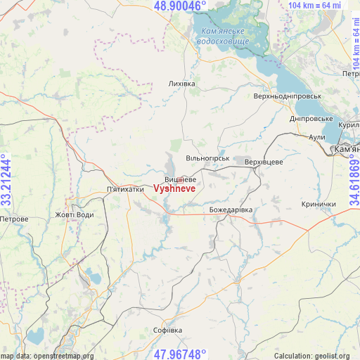
Vyshneve GPS coordinates[2]
48° 26' 9.996" North, 33° 54' 56.016" East
| Map corner | latitude | longitude |
|---|---|---|
| Upper-left | 48.90046°, | 33.21244° |
| Center: | 48.43611°, | 33.91556° |
| Lower-right: | 47.96748°, | 34.61869° |
| Map W x H: | 103.7×103.7 km | = 64.4×64.4mi |
| max Lat: | 52.18903° ⇑46.5% North |
| Vyshneve: | 48.43611° |
| min Lat: | ⇓53.5% South 44.39214° |
| min Long | Vyshneve | max Long |
| 22.20555° | 33.91556° | 40.13222° |
| W 60.3%⇐ | ⇒39.7% E |
Elevation
Elevation of Vyshneve is 125 m = 410 ft, and this is 30.8 m = 101 ft below average elevation for this country.
| Max E: |
886 m = 2907 ft | 53.1% |
| Avg. | 155.8 m = 511 ft | |
| Vyshneve | 125 m = 410 ft | |
Min E: |
-3 m = -10 ft | 46.9% |
See also: Ukraine elevation on elevation.city.
Geographical zone
Vyshneve is located in North temperate zone (between Tropic of Cancer and the Arctic Circle). Distance of this North polar circle is 2015.6 km =1252.4 mi to North.| Distance of | km | miles | from Vyshneve |
|---|---|---|---|
| North Pole | 4621.5 | 2871.7 | to North |
| Arctic Circle | 2015.6 | 1252.4 | to North |
| Tropic Cancer | 2779.7 | 1727.2 | to South |
| Equator | 5385.6 | 3346.5 | to South |


Nearby cities:
15 places around Vyshneve: (largest is in red/bold)
• Auly
42.7 km =26.5 mi,  70°
70°
• Kamianske
51.3 km =31.9 mi,  80°
80°
• Krynychky
41.3 km =25.7 mi,  99°
99°
• Lozuvatka
62.9 km =39.1 mi,  227°
227°
• Lykhivka
27.9 km =17.3 mi,  1°
1°
• Novomykolayivka
36.3 km =22.6 mi, 68°
• Novyy Starodub
55.4 km =34.4 mi,  279°
279°
• Onufriyivka
62.6 km =38.9 mi,  326°
326°
• Petrove
50.2 km =31.2 mi,  255°
255°
• Petrykivka
62.1 km =38.6 mi,  58°
58°
• Piatykhatky
15.3 km =9.5 mi, 260°
• Sofiyivka
43.2 km =26.8 mi,  183°
183°
• Surs’ko-Mykhaylivka
62.7 km =39 mi,  106°
106°
• Verkhn’odniprovs’k
39.1 km =24.3 mi,  52°
52°
• Zhovti Vody
32.1 km =19.9 mi,  251°
251°
Sources, notices
• [Note1] Compared only with cities in Ukraine existing in our database
• [Src1] Map data: © OpenStreetMap contributors (CC-BY-SA)
• [Src2] Other city data from geonames.org with taken over terms of usage.
• [Src3] Geographical zone / Annual Mean Temperature by Robert A. Rohde @ Wikipedia
