Zhovti Vody geodata
Zhovti Vody (Dnipropetrovsk) is a populated place; located in Ukraine in Europe/Kiev (GMT+3) time zone. With population of 51,559 people, there are 92 cities with bigger population in this country. Compared to other cities in Ukraine, 51.2% of cities are located further ↓South; 51.8% of cities are located further ←West and 54.6% of cities have lower elevation than Zhovti Vody. Note1


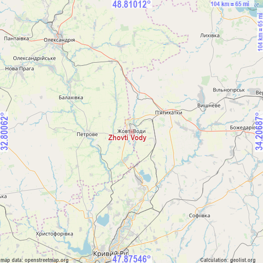
Zhovti Vody GPS coordinates[2]
48° 20' 41.748" North, 33° 30' 13.464" East
| Map corner | latitude | longitude |
|---|---|---|
| Upper-left | 48.81012°, | 32.80062° |
| Center: | 48.34493°, | 33.50374° |
| Lower-right: | 47.87546°, | 34.20687° |
| Map W x H: | 103.9×103.9 km | = 64.6×64.6mi |
| max Lat: | 52.18903° ⇑48.8% North |
| Zhovti Vody: | 48.34493° |
| min Lat: | ⇓51.2% South 44.39214° |
| min Long | Zhovti Vody | max Long |
| 22.20555° | 33.50374° | 40.13222° |
| W 51.8%⇐ | ⇒48.2% E |
Elevation
Elevation of Zhovti Vody is 151 m = 495 ft, and this is 4.8 m = 16 ft below average elevation for this country.
| Max E: |
886 m = 2907 ft | 45.4% |
| Avg. | 155.8 m = 511 ft | |
| Zhovti Vody | 151 m = 495 ft | |
Min E: |
-3 m = -10 ft | 54.6% |
See also: Zhovti Vody elevation on elevation.city.
Geographical zone
Zhovti Vody is located in North temperate zone (between Tropic of Cancer and the Arctic Circle). Distance of this North polar circle is 2025.7 km =1258.7 mi to North.| Distance of | km | miles | from Zhovti Vody |
|---|---|---|---|
| North Pole | 4631.6 | 2877.9 | to North |
| Arctic Circle | 2025.7 | 1258.7 | to North |
| Tropic Cancer | 2769.5 | 1720.9 | to South |
| Equator | 5375.5 | 3340.2 | to South |


Nearby cities:
15 places around Zhovti Vody: (largest is in red/bold)
• Dolyns'ka
60.6 km =37.7 mi,  244°
244°
• Kryvyi Rih
49.3 km =30.6 mi,  190°
190°
• Lozuvatka
35.8 km =22.2 mi,  206°
206°
• Lykhivka
49 km =30.4 mi,  39°
39°
• Nova Praha
50.8 km =31.6 mi,  299°
299°
• Novhorodka
62.5 km =38.8 mi,  272°
272°
• Novyy Starodub
30.9 km =19.2 mi,  307°
307°
• Oleksandriya
46 km =28.6 mi,  321°
321°
• Oleksandriys’ke
48.2 km =30 mi, 307°
• Pantayivka
58.5 km =36.4 mi, 308°
• Petrove
18.4 km =11.4 mi,  262°
262°
• Piatykhatky
17.1 km =10.6 mi,  63°
63°
• Pryyutivka
52.6 km =32.7 mi, 322°
• Sofiyivka
43 km =26.7 mi,  140°
140°
• Vyshneve
32.1 km =19.9 mi,  71°
71°
Sources, notices
• [Note1] Compared only with cities in Ukraine existing in our database
• [Src1] Map data: © OpenStreetMap contributors (CC-BY-SA)
• [Src2] Other city data from geonames.org with taken over terms of usage.
• [Src3] Geographical zone / Annual Mean Temperature by Robert A. Rohde @ Wikipedia
