Zlynka geodata
Zlynka (Kirovohrad) is a populated place; located in Ukraine in Europe/Kiev (GMT+3) time zone. With population of 4,981 people, there are 656 cities with bigger population in this country. Compared to other cities in Ukraine, 54.9% of cities are located further ↓South; 58.9% of cities are located further →East and 62.3% of cities have lower elevation than Zlynka. Note1


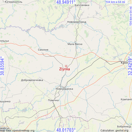
Zlynka GPS coordinates[2]
48° 29' 6.756" North, 31° 32' 20.616" East
| Map corner | latitude | longitude |
|---|---|---|
| Upper-left | 48.94911°, | 30.83594° |
| Center: | 48.48521°, | 31.53906° |
| Lower-right: | 48.01703°, | 32.24219° |
| Map W x H: | 103.6×103.6 km | = 64.4×64.4mi |
| max Lat: | 52.18903° ⇑45.1% North |
| Zlynka: | 48.48521° |
| min Lat: | ⇓54.9% South 44.39214° |
| min Long | Zlynka | max Long |
| 22.20555° | 31.53906° | 40.13222° |
| W 41.1%⇐ | ⇒58.9% E |
Elevation
Elevation of Zlynka is 177 m = 581 ft, and this is 21.2 m = 70 ft above average elevation for this country.
| Max E: |
886 m = 2907 ft | 37.7% |
| Zlynka | 177 m 581 ft | |
| Avg. | 155.8 m = 511 ft | |
Min E: |
-3 m = -10 ft | 62.3% |
See also: Ukraine elevation on elevation.city.
Geographical zone
Zlynka is located in North temperate zone (between Tropic of Cancer and the Arctic Circle). Distance of this North polar circle is 2010.1 km =1249 mi to North.| Distance of | km | miles | from Zlynka |
|---|---|---|---|
| North Pole | 4616 | 2868.2 | to North |
| Arctic Circle | 2010.1 | 1249 | to North |
| Tropic Cancer | 2785.1 | 1730.6 | to South |
| Equator | 5391 | 3349.8 | to South |


Nearby cities:
15 places around Zlynka: (largest is in red/bold)
• Dobrovelychkivka
28.6 km =17.8 mi,  247°
247°
• Kapitanivka
49.8 km =30.9 mi,  15°
15°
• Kompaniyivka
55.8 km =34.7 mi,  117°
117°
• Kropyvnytskyi
53.2 km =33.1 mi,  86°
86°
• Lebedyn
53.1 km =33 mi,  359°
359°
• Lypnyazhka
34.4 km =21.4 mi,  262°
262°
• Lysa Hora
47.2 km =29.3 mi,  222°
222°
• Mala Vyska
19 km =11.8 mi, 22°
• Novoarkhanhel’s’k
56.4 km =35 mi,  289°
289°
• Novomyrhorod
33.8 km =21 mi,  12°
12°
• Novoukrayinka
17.7 km =11 mi,  182°
182°
• Pomichna
28.5 km =17.7 mi,  198°
198°
• Rivne
30.9 km =19.2 mi,  148°
148°
• Tyshkivka
44 km =27.3 mi,  271°
271°
• Vil’shanka
56.3 km =35 mi,  240°
240°
Sources, notices
• [Note1] Compared only with cities in Ukraine existing in our database
• [Src1] Map data: © OpenStreetMap contributors (CC-BY-SA)
• [Src2] Other city data from geonames.org with taken over terms of usage.
• [Src3] Geographical zone / Annual Mean Temperature by Robert A. Rohde @ Wikipedia
