Shchors geodata
Shchors (Chernihiv) is a seat of a second-order administrative division; located in Ukraine in Europe/Kiev (GMT+3) time zone. With population of 11,857 people, there are 311 cities with bigger population in this country. Compared to other cities in Ukraine, 99.4% of cities are located further ↓South; 57.4% of cities are located further →East and 53.1% of cities have higher elevation than Shchors. Note1


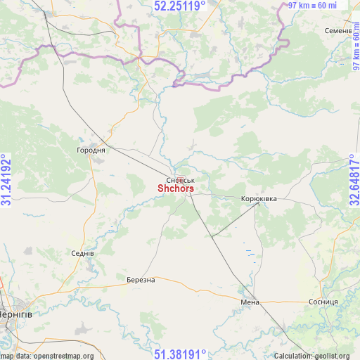
Shchors GPS coordinates[2]
51° 49' 7.14" North, 31° 56' 42.144" East
| Map corner | latitude | longitude |
|---|---|---|
| Upper-left | 52.25119°, | 31.24192° |
| Center: | 51.81865°, | 31.94504° |
| Lower-right: | 51.38191°, | 32.64817° |
| Map W x H: | 96.7×96.7 km | = 60.1×60.1mi |
| max Lat: | 52.18903° ⇑0.6% North |
| Shchors: | 51.81865° |
| min Lat: | ⇓99.4% South 44.39214° |
| min Long | Shchors | max Long |
| 22.20555° | 31.94504° | 40.13222° |
| W 42.6%⇐ | ⇒57.4% E |
Elevation
Elevation of Shchors is 125 m = 410 ft, and this is 30.8 m = 101 ft below average elevation for this country.
| Max E: |
886 m = 2907 ft | 53.1% |
| Avg. | 155.8 m = 511 ft | |
| Shchors | 125 m = 410 ft | |
Min E: |
-3 m = -10 ft | 46.9% |
See also: Ukraine elevation on elevation.city.
Geographical zone
Shchors is located in North temperate zone (between Tropic of Cancer and the Arctic Circle). Distance of this North polar circle is 1639.5 km =1018.7 mi to North.| Distance of | km | miles | from Shchors |
|---|---|---|---|
| North Pole | 4245.4 | 2638 | to North |
| Arctic Circle | 1639.5 | 1018.7 | to North |
| Tropic Cancer | 3155.8 | 1960.9 | to South |
| Equator | 5761.7 | 3580.2 | to South |


Nearby cities:
15 places around Shchors: (largest is in red/bold)
• Avdiyivka
59 km =36.7 mi,  94°
94°
• Berezna
29.6 km =18.4 mi,  201°
201°
• Borzna
71 km =44.1 mi,  152°
152°
• Chernihiv
57.3 km =35.6 mi,  232°
232°
• Dobryanka
58.7 km =36.5 mi,  297°
297°
• Horodnya
25.2 km =15.7 mi,  288°
288°
• Kholmy
45.4 km =28.2 mi,  82°
82°
• Koryukivka
21.6 km =13.4 mi,  104°
104°
• Kulykivka
53.6 km =33.3 mi, 202°
• Mena
37.9 km =23.5 mi, 150°
• Novi Yarylovychi
68.5 km =42.6 mi, 290°
• Ripky
59.2 km =36.8 mi,  268°
268°
• Sedniv
32.5 km =20.2 mi, 233°
• Semenivka
59.2 km =36.8 mi,  47°
47°
• Sosnytsya
50.4 km =31.3 mi,  130°
130°
Sources, notices
• [Note1] Compared only with cities in Ukraine existing in our database
• [Src1] Map data: © OpenStreetMap contributors (CC-BY-SA)
• [Src2] Other city data from geonames.org with taken over terms of usage.
• [Src3] Geographical zone / Annual Mean Temperature by Robert A. Rohde @ Wikipedia
