Savyntsi geodata
Savyntsi (Kharkiv) is a populated place; located in Ukraine in Europe/Kiev (GMT+3) time zone. With population of 5,326 people, there are 621 cities with bigger population in this country. Compared to other cities in Ukraine, 72.8% of cities are located further ↓South; 91.1% of cities are located further ←West and 61.4% of cities have higher elevation than Savyntsi. Note1


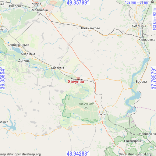
Savyntsi GPS coordinates[2]
49° 24' 9.252" North, 37° 3' 45.576" East
| Map corner | latitude | longitude |
|---|---|---|
| Upper-left | 49.85799°, | 36.35954° |
| Center: | 49.40257°, | 37.06266° |
| Lower-right: | 48.94288°, | 37.76579° |
| Map W x H: | 101.8×101.7 km | = 63.3×63.2mi |
| max Lat: | 52.18903° ⇑27.2% North |
| Savyntsi: | 49.40257° |
| min Lat: | ⇓72.8% South 44.39214° |
| min Long | Savyntsi | max Long |
| 22.20555° | 37.06266° | 40.13222° |
| W 91.1%⇐ | ⇒8.9% E |
Elevation
Elevation of Savyntsi is 101 m = 331 ft, and this is 54.8 m = 180 ft below average elevation for this country.
| Max E: |
886 m = 2907 ft | 61.4% |
| Avg. | 155.8 m = 511 ft | |
| Savyntsi | 101 m = 331 ft | |
Min E: |
-3 m = -10 ft | 38.6% |
See also: Ukraine elevation on elevation.city.
Geographical zone
Savyntsi is located in North temperate zone (between Tropic of Cancer and the Arctic Circle). Distance of this North polar circle is 1908.1 km =1185.6 mi to North.| Distance of | km | miles | from Savyntsi |
|---|---|---|---|
| North Pole | 4514 | 2804.9 | to North |
| Arctic Circle | 1908.1 | 1185.6 | to North |
| Tropic Cancer | 2887.1 | 1794 | to South |
| Equator | 5493.1 | 3413.3 | to South |


Nearby cities:
15 places around Savyntsi: (largest is in red/bold)
• Balakliya
16.1 km =10 mi,  294°
294°
• Barvinkove
54.9 km =34.1 mi,  183°
183°
• Borova
40.5 km =25.2 mi,  93°
93°
• Chervonyy Oskil
36.2 km =22.5 mi,  133°
133°
• Izyum
25.4 km =15.8 mi,  147°
147°
• Kivsharivka
51.8 km =32.2 mi,  60°
60°
• Kupjansk
52.5 km =32.6 mi,  49°
49°
• Lyman
48 km =29.8 mi,  296°
296°
• Malynivka
51.8 km =32.2 mi,  332°
332°
• Pechenihy
53 km =32.9 mi,  349°
349°
• Petrivs’ke
27.7 km =17.2 mi,  205°
205°
• Shevchenkove
33.6 km =20.9 mi,  13°
13°
• Slobozhans’ke
44.4 km =27.6 mi, 299°
• Studenok
46.3 km =28.8 mi,  138°
138°
• Yats’kivka
41.6 km =25.8 mi, 126°
Sources, notices
• [Note1] Compared only with cities in Ukraine existing in our database
• [Src1] Map data: © OpenStreetMap contributors (CC-BY-SA)
• [Src2] Other city data from geonames.org with taken over terms of usage.
• [Src3] Geographical zone / Annual Mean Temperature by Robert A. Rohde @ Wikipedia
