Oleksandrivka geodata
Oleksandrivka (Kirovohrad) is a seat of a second-order administrative division; located in Ukraine in Europe/Kiev (GMT+3) time zone. With population of 10,687 people, there are 338 cities with bigger population in this country. Compared to other cities in Ukraine, 65.3% of cities are located further ↓South; 56.5% of cities are located further →East and 52.2% of cities have higher elevation than Oleksandrivka. Note1


Oleksandrivka GPS coordinates[2]
48° 57' 48.096" North, 32° 14' 5.712" East
| Map corner | latitude | longitude |
|---|---|---|
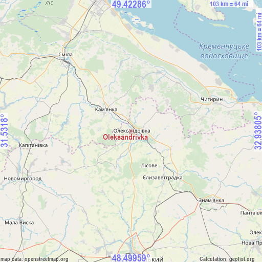
| Upper-left | 49.42286°, | 31.5318° |
| Center: | 48.96336°, | 32.23492° |
| Lower-right: | 48.49959°, | 32.93805° |
| Map W x H: | 102.7×102.7 km | = 63.8×63.8mi |
| max Lat: | 52.18903° ⇑34.7% North |
| Oleksandrivka: | 48.96336° |
| min Lat: | ⇓65.3% South 44.39214° |
| min Long | Oleksandrivka | max Long |
| 22.20555° | 32.23492° | 40.13222° |
| W 43.5%⇐ | ⇒56.5% E |
Elevation
Elevation of Oleksandrivka is 127 m = 417 ft, and this is 28.8 m = 94 ft below average elevation for this country.
| Max E: |
886 m = 2907 ft | 52.2% |
| Avg. | 155.8 m = 511 ft | |
| Oleksandrivka | 127 m = 417 ft | |
Min E: |
-3 m = -10 ft | 47.8% |
See also: Ukraine elevation on elevation.city.
Geographical zone
Oleksandrivka is located in North temperate zone (between Tropic of Cancer and the Arctic Circle). Distance of this North polar circle is 1957 km =1216 mi to North.| Distance of | km | miles | from Oleksandrivka |
|---|---|---|---|
| North Pole | 4562.8 | 2835.2 | to North |
| Arctic Circle | 1957 | 1216 | to North |
| Tropic Cancer | 2838.3 | 1763.6 | to South |
| Equator | 5444.2 | 3382.9 | to South |


Nearby cities:
15 places around Oleksandrivka: (largest is in red/bold)
• Adzhamka
51.7 km =32.1 mi,  154°
154°
• Cherkasy
53.2 km =33.1 mi,  346°
346°
• Chervona Sloboda
45.9 km =28.5 mi, 352°
• Chyhyryn
33.5 km =20.8 mi,  66°
66°
• Dmytrivka
39.8 km =24.7 mi,  117°
117°
• Kamianka
12.2 km =7.6 mi,  308°
308°
• Kapitanivka
38.2 km =23.7 mi,  262°
262°
• Kropyvnytskyi
50.1 km =31.1 mi,  177°
177°
• Lebedyn
51.7 km =32.1 mi,  269°
269°
• Novomyrhorod
47.9 km =29.8 mi,  244°
244°
• Smila
38.4 km =23.9 mi,  318°
318°
• Subottsi
40.1 km =24.9 mi, 148°
• Tsvitkove
55 km =34.2 mi,  292°
292°
• Yelyzavethradka
21.6 km =13.4 mi, 145°
• Znomenka
42 km =26.1 mi,  131°
131°
Sources, notices
• [Note1] Compared only with cities in Ukraine existing in our database
• [Src1] Map data: © OpenStreetMap contributors (CC-BY-SA)
• [Src2] Other city data from geonames.org with taken over terms of usage.
• [Src3] Geographical zone / Annual Mean Temperature by Robert A. Rohde @ Wikipedia
