Nyzy geodata
Nyzy (Sumy) is a populated place; located in Ukraine in Europe/Kiev (GMT+3) time zone. With population of 2,819 people, there are 987 cities with bigger population in this country. Compared to other cities in Ukraine, 94.1% of cities are located further ↓South; 77.5% of cities are located further ←West and 52.7% of cities have higher elevation than Nyzy. Note1


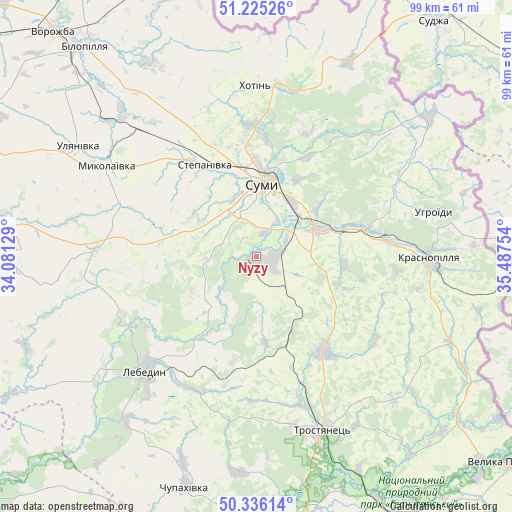
Nyzy GPS coordinates[2]
50° 46' 58.116" North, 34° 47' 3.876" East
| Map corner | latitude | longitude |
|---|---|---|
| Upper-left | 51.22526°, | 34.08129° |
| Center: | 50.78281°, | 34.78441° |
| Lower-right: | 50.33614°, | 35.48754° |
| Map W x H: | 98.9×98.9 km | = 61.5×61.5mi |
| max Lat: | 52.18903° ⇑5.9% North |
| Nyzy: | 50.78281° |
| min Lat: | ⇓94.1% South 44.39214° |
| min Long | Nyzy | max Long |
| 22.20555° | 34.78441° | 40.13222° |
| W 77.5%⇐ | ⇒22.5% E |
Elevation
Elevation of Nyzy is 126 m = 413 ft, and this is 29.8 m = 98 ft below average elevation for this country.
| Max E: |
886 m = 2907 ft | 52.7% |
| Avg. | 155.8 m = 511 ft | |
| Nyzy | 126 m = 413 ft | |
Min E: |
-3 m = -10 ft | 47.3% |
See also: Ukraine elevation on elevation.city.
Geographical zone
Nyzy is located in North temperate zone (between Tropic of Cancer and the Arctic Circle). Distance of this North polar circle is 1754.7 km =1090.3 mi to North.| Distance of | km | miles | from Nyzy |
|---|---|---|---|
| North Pole | 4360.5 | 2709.5 | to North |
| Arctic Circle | 1754.7 | 1090.3 | to North |
| Tropic Cancer | 3040.6 | 1889.3 | to South |
| Equator | 5646.5 | 3508.6 | to South |


Nearby cities:
15 places around Nyzy: (largest is in red/bold)
• Bilopillya
52.5 km =32.6 mi,  321°
321°
• Boromlya
22.5 km =14 mi,  144°
144°
• Krasnopillya
33.4 km =20.8 mi,  91°
91°
• Kyrykivka
52.1 km =32.4 mi,  153°
153°
• Lebedyn
30.5 km =19 mi,  223°
223°
• Mezenivka
40.7 km =25.3 mi,  113°
113°
• Nedryhayliv
64.1 km =39.8 mi,  275°
275°
• Okhtyrka
53.1 km =33 mi,  171°
171°
• Sumy
15.5 km =9.6 mi,  4°
4°
• Terny
61.5 km =38.2 mi,  291°
291°
• Trostyanets’
35.5 km =22.1 mi,  158°
158°
• Velyka Pysarivka
63.2 km =39.3 mi,  129°
129°
• Verkhnya Syrovatka
13.3 km =8.3 mi,  67°
67°
• Vorozhba
58.7 km =36.5 mi, 317°
• Zin’kiv
70.5 km =43.8 mi,  204°
204°
Sources, notices
• [Note1] Compared only with cities in Ukraine existing in our database
• [Src1] Map data: © OpenStreetMap contributors (CC-BY-SA)
• [Src2] Other city data from geonames.org with taken over terms of usage.
• [Src3] Geographical zone / Annual Mean Temperature by Robert A. Rohde @ Wikipedia
