Nedryhayliv geodata
Nedryhayliv (Sumy) is a seat of a second-order administrative division; located in Ukraine in Europe/Kiev (GMT+3) time zone. With population of 6,031 people, there are 565 cities with bigger population in this country. Compared to other cities in Ukraine, 94.7% of cities are located further ↓South; 59.9% of cities are located further ←West and 52.2% of cities have higher elevation than Nedryhayliv. Note1


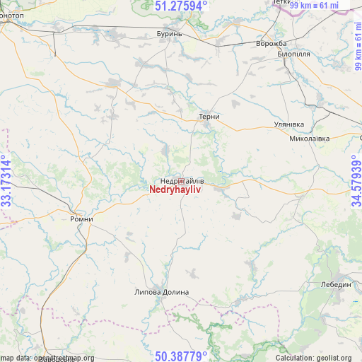
Nedryhayliv GPS coordinates[2]
50° 50' 2.328" North, 33° 52' 34.536" East
| Map corner | latitude | longitude |
|---|---|---|
| Upper-left | 51.27594°, | 33.17314° |
| Center: | 50.83398°, | 33.87626° |
| Lower-right: | 50.38779°, | 34.57939° |
| Map W x H: | 98.8×98.8 km | = 61.4×61.4mi |
| max Lat: | 52.18903° ⇑5.3% North |
| Nedryhayliv: | 50.83398° |
| min Lat: | ⇓94.7% South 44.39214° |
| min Long | Nedryhayliv | max Long |
| 22.20555° | 33.87626° | 40.13222° |
| W 59.9%⇐ | ⇒40.1% E |
Elevation
Elevation of Nedryhayliv is 127 m = 417 ft, and this is 28.8 m = 94 ft below average elevation for this country.
| Max E: |
886 m = 2907 ft | 52.2% |
| Avg. | 155.8 m = 511 ft | |
| Nedryhayliv | 127 m = 417 ft | |
Min E: |
-3 m = -10 ft | 47.8% |
See also: Ukraine elevation on elevation.city.
Geographical zone
Nedryhayliv is located in North temperate zone (between Tropic of Cancer and the Arctic Circle). Distance of this North polar circle is 1749 km =1086.8 mi to North.| Distance of | km | miles | from Nedryhayliv |
|---|---|---|---|
| North Pole | 4354.9 | 2706 | to North |
| Arctic Circle | 1749 | 1086.8 | to North |
| Tropic Cancer | 3046.3 | 1892.9 | to South |
| Equator | 5652.2 | 3512.1 | to South |


Nearby cities:
15 places around Nedryhayliv: (largest is in red/bold)
• Bilopillya
46.6 km =29 mi,  40°
40°
• Buryn’
40.7 km =25.3 mi,  355°
355°
• Hadyach
52.1 km =32.4 mi,  171°
171°
• Konotop
65.3 km =40.6 mi,  313°
313°
• Lebedyn
51 km =31.7 mi,  122°
122°
• Lokhvytsya
67.7 km =42.1 mi,  219°
219°
• Lypova Dolyna
30.5 km =19 mi,  190°
190°
• Nyzy
64.1 km =39.8 mi,  95°
95°
• Putyvl’
56 km =34.8 mi, 359°
• Romny
29.7 km =18.5 mi,  251°
251°
• Sloboda
44.7 km =27.8 mi,  335°
335°
• Sumy
65.6 km =40.8 mi,  81°
81°
• Talalayivka
51.4 km =31.9 mi,  270°
270°
• Terny
18.5 km =11.5 mi,  20°
20°
• Vorozhba
44.7 km =27.8 mi,  32°
32°
Sources, notices
• [Note1] Compared only with cities in Ukraine existing in our database
• [Src1] Map data: © OpenStreetMap contributors (CC-BY-SA)
• [Src2] Other city data from geonames.org with taken over terms of usage.
• [Src3] Geographical zone / Annual Mean Temperature by Robert A. Rohde @ Wikipedia
