Mohyliv-Podilskyi geodata
Mohyliv-Podilskyi (Vinnyts'ka) is a seat of a second-order administrative division; located in Ukraine in Europe/Kiev (GMT+3) time zone. With population of 32,500 people, there are 134 cities with bigger population in this country. Compared to other cities in Ukraine, 54% of cities are located further ↓South; 76.3% of cities are located further →East and 72.8% of cities have higher elevation than Mohyliv-Podilskyi. Note1


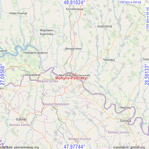
Mohyliv-Podilskyi GPS coordinates[2]
48° 26' 45.528" North, 27° 47' 53.52" East
| Map corner | latitude | longitude |
|---|---|---|
| Upper-left | 48.91024°, | 27.09508° |
| Center: | 48.44598°, | 27.7982° |
| Lower-right: | 47.97744°, | 28.50133° |
| Map W x H: | 103.7×103.7 km | = 64.4×64.4mi |
| max Lat: | 52.18903° ⇑46% North |
| Mohyliv-Podilskyi: | 48.44598° |
| min Lat: | ⇓54% South 44.39214° |
| min Long | Mohyliv-Podilsk | max Long |
| 22.20555° | 27.7982° | 40.13222° |
| W 23.7%⇐ | ⇒76.3% E |
Elevation
Elevation of Mohyliv-Podilskyi is 68 m = 223 ft, and this is 87.8 m = 288 ft below average elevation for this country.
| Max E: |
886 m = 2907 ft | 72.8% |
| Avg. | 155.8 m = 511 ft | |
| Mohyliv-Podilskyi | 68 m = 223 ft | |
Min E: |
-3 m = -10 ft | 27.2% |
See also: Ukraine elevation on elevation.city.
Geographical zone
Mohyliv-Podilskyi is located in North temperate zone (between Tropic of Cancer and the Arctic Circle). Distance of this North polar circle is 2014.5 km =1251.8 mi to North.| Distance of | km | miles | from Mohyliv-Podilskyi |
|---|---|---|---|
| North Pole | 4620.4 | 2871 | to North |
| Arctic Circle | 2014.5 | 1251.8 | to North |
| Tropic Cancer | 2780.8 | 1727.9 | to South |
| Equator | 5386.7 | 3347.1 | to South |


Nearby cities:
15 places around Mohyliv-Podilskyi: (largest is in red/bold)
• Chernivtsi
25.7 km =16 mi,  65°
65°
• Klembivka
45.6 km =28.3 mi,  97°
97°
• Kopayhorod
45.9 km =28.5 mi,  359°
359°
• Murafa
47.1 km =29.3 mi,  40°
40°
• Murovani Kurylivtsi
37.1 km =23.1 mi,  326°
326°
• Nova Ushytsya
58.1 km =36.1 mi,  318°
318°
• Novodnistrovs’k
30.4 km =18.9 mi,  300°
300°
• Serebriya
5.9 km =3.7 mi,  280°
280°
• Sharhorod
40 km =24.9 mi,  30°
30°
• Sokyryany
28.1 km =17.5 mi,  270°
270°
• Tomashpil’
54 km =33.6 mi,  78°
78°
• Vapnyarka
70.4 km =43.7 mi, 81°
• Vendychany
18.4 km =11.4 mi, 358°
• Yampil’
42.3 km =26.3 mi,  122°
122°
• Zhmerynka
69.6 km =43.2 mi,  19°
19°
Sources, notices
• [Note1] Compared only with cities in Ukraine existing in our database
• [Src1] Map data: © OpenStreetMap contributors (CC-BY-SA)
• [Src2] Other city data from geonames.org with taken over terms of usage.
• [Src3] Geographical zone / Annual Mean Temperature by Robert A. Rohde @ Wikipedia
