Vapnyarka geodata
Vapnyarka (Vinnyts'ka) is a populated place; located in Ukraine in Europe/Kiev (GMT+3) time zone. With population of 8,443 people, there are 422 cities with bigger population in this country. Compared to other cities in Ukraine, 56.2% of cities are located further ↓South; 73.7% of cities are located further →East and 90.9% of cities have lower elevation than Vapnyarka. Note1


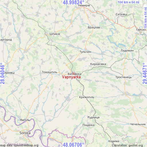
Vapnyarka GPS coordinates[2]
48° 32' 5.244" North, 28° 44' 36.888" East
| Map corner | latitude | longitude |
|---|---|---|
| Upper-left | 48.99824°, | 28.04046° |
| Center: | 48.53479°, | 28.74358° |
| Lower-right: | 48.06706°, | 29.44671° |
| Map W x H: | 103.5×103.5 km | = 64.3×64.3mi |
| max Lat: | 52.18903° ⇑43.8% North |
| Vapnyarka: | 48.53479° |
| min Lat: | ⇓56.2% South 44.39214° |
| min Long | Vapnyarka | max Long |
| 22.20555° | 28.74358° | 40.13222° |
| W 26.3%⇐ | ⇒73.7% E |
Elevation
Elevation of Vapnyarka is 313 m = 1027 ft, and this is 157.2 m = 516 ft above average elevation for this country.
| Max E: |
886 m = 2907 ft | 9.1% |
| Vapnyarka | 313 m 1027 ft | |
| Avg. | 155.8 m = 511 ft | |
Min E: |
-3 m = -10 ft | 90.9% |
See also: Ukraine elevation on elevation.city.
Geographical zone
Vapnyarka is located in North temperate zone (between Tropic of Cancer and the Arctic Circle). Distance of this North polar circle is 2004.6 km =1245.6 mi to North.| Distance of | km | miles | from Vapnyarka |
|---|---|---|---|
| North Pole | 4610.5 | 2864.8 | to North |
| Arctic Circle | 2004.6 | 1245.6 | to North |
| Tropic Cancer | 2790.6 | 1734 | to South |
| Equator | 5396.6 | 3353.3 | to South |


Nearby cities:
15 places around Vapnyarka: (largest is in red/bold)
• Bratslav
35.1 km =21.8 mi,  24°
24°
• Chernivtsi
46.3 km =28.8 mi,  271°
271°
• Klembivka
29.3 km =18.2 mi,  236°
236°
• Kryzhopil’
19.2 km =11.9 mi,  151°
151°
• Ladyzhyn
39.9 km =24.8 mi,  65°
65°
• Murafa
46.6 km =29 mi,  303°
303°
• Nemyriv
49 km =30.4 mi,  8°
8°
• Obodivka
39.9 km =24.8 mi,  111°
111°
• Pishchanka
37.9 km =23.5 mi,  163°
163°
• Tomashpil’
16.7 km =10.4 mi, 272°
• Torkanivka
37.9 km =23.5 mi,  128°
128°
• Trostyanets’
36.3 km =22.6 mi,  94°
94°
• Tsybulevka
31.2 km =19.4 mi,  121°
121°
• Tulchyn
17.3 km =10.7 mi,  25°
25°
• Yampil’
47.1 km =29.3 mi,  226°
226°
Sources, notices
• [Note1] Compared only with cities in Ukraine existing in our database
• [Src1] Map data: © OpenStreetMap contributors (CC-BY-SA)
• [Src2] Other city data from geonames.org with taken over terms of usage.
• [Src3] Geographical zone / Annual Mean Temperature by Robert A. Rohde @ Wikipedia
