Yampil’ geodata
Yampil’ (Vinnyts'ka) is a seat of a second-order administrative division; located in Ukraine in Europe/Kiev (GMT+3) time zone. In our database, there are 1661 cities with bigger population. Compared to other cities in Ukraine, 51.3% of cities are located further ↑North; 75.2% of cities are located further →East and 75.7% of cities have higher elevation than Yampil’. Note1


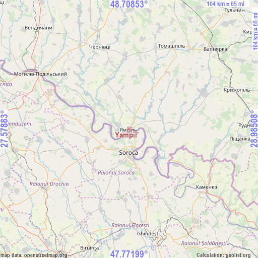
Yampil’ GPS coordinates[2]
48° 14' 32.64" North, 28° 16' 55.02" East
| Map corner | latitude | longitude |
|---|---|---|
| Upper-left | 48.70853°, | 27.57883° |
| Center: | 48.2424°, | 28.28195° |
| Lower-right: | 47.77199°, | 28.98508° |
| Map W x H: | 104.1×104.1 km | = 64.7×64.7mi |
| max Lat: | 52.18903° ⇑51.3% North |
| Yampil’: | 48.2424° |
| min Lat: | ⇓48.7% South 44.39214° |
| min Long | Yampil’ | max Long |
| 22.20555° | 28.28195° | 40.13222° |
| W 24.8%⇐ | ⇒75.2% E |
Elevation
Elevation of Yampil’ is 58 m = 190 ft, and this is 97.8 m = 321 ft below average elevation for this country.
| Max E: |
886 m = 2907 ft | 75.7% |
| Avg. | 155.8 m = 511 ft | |
| Yampil’ | 58 m = 190 ft | |
Min E: |
-3 m = -10 ft | 24.3% |
See also: Ukraine elevation on elevation.city.
Geographical zone
Yampil’ is located in North temperate zone (between Tropic of Cancer and the Arctic Circle). Distance of this North polar circle is 2037.1 km =1265.8 mi to North.| Distance of | km | miles | from Yampil’ |
|---|---|---|---|
| North Pole | 4643 | 2885 | to North |
| Arctic Circle | 2037.1 | 1265.8 | to North |
| Tropic Cancer | 2758.1 | 1713.8 | to South |
| Equator | 5364.1 | 3333.1 | to South |


Nearby cities:
15 places around Yampil’: (largest is in red/bold)
• Chernivtsi
35.6 km =22.1 mi,  339°
339°
• Klembivka
19 km =11.8 mi,  30°
30°
• Kodyma
64.5 km =40.1 mi,  104°
104°
• Kryzhopil’
45.9 km =28.5 mi,  70°
70°
• Mohyliv-Podilskyi
42.3 km =26.3 mi,  302°
302°
• Murafa
58.6 km =36.4 mi,  355°
355°
• Pishchanka
44.9 km =27.9 mi,  94°
94°
• Serebriya
47.9 km =29.8 mi, 299°
• Sharhorod
59.1 km =36.7 mi,  345°
345°
• Tomashpil’
37.6 km =23.4 mi, 27°
• Tsybulevka
62.8 km =39 mi,  75°
75°
• Tulchyn
63.6 km =39.5 mi,  40°
40°
• Vapnyarka
47.1 km =29.3 mi,  46°
46°
• Vendychany
54.7 km =34 mi,  318°
318°
• Zagnitkiv
50.1 km =31.1 mi,  115°
115°
Sources, notices
• [Note1] Compared only with cities in Ukraine existing in our database
• [Src1] Map data: © OpenStreetMap contributors (CC-BY-SA)
• [Src2] Other city data from geonames.org with taken over terms of usage.
• [Src3] Geographical zone / Annual Mean Temperature by Robert A. Rohde @ Wikipedia
