Klembivka geodata
Klembivka (Vinnyts'ka) is a populated place; located in Ukraine in Europe/Kiev (GMT+3) time zone. With population of 3,692 people, there are 798 cities with bigger population in this country. Compared to other cities in Ukraine, 52.5% of cities are located further ↓South; 75% of cities are located further →East and 54.6% of cities have lower elevation than Klembivka. Note1


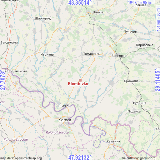
Klembivka GPS coordinates[2]
48° 23' 25.332" North, 28° 24' 39.312" East
| Map corner | latitude | longitude |
|---|---|---|
| Upper-left | 48.85514°, | 27.7078° |
| Center: | 48.39037°, | 28.41092° |
| Lower-right: | 47.92132°, | 29.11405° |
| Map W x H: | 103.8×103.8 km | = 64.5×64.5mi |
| max Lat: | 52.18903° ⇑47.5% North |
| Klembivka: | 48.39037° |
| min Lat: | ⇓52.5% South 44.39214° |
| min Long | Klembivka | max Long |
| 22.20555° | 28.41092° | 40.13222° |
| W 25%⇐ | ⇒75% E |
Elevation
Elevation of Klembivka is 151 m = 495 ft, and this is 4.8 m = 16 ft below average elevation for this country.
| Max E: |
886 m = 2907 ft | 45.4% |
| Avg. | 155.8 m = 511 ft | |
| Klembivka | 151 m = 495 ft | |
Min E: |
-3 m = -10 ft | 54.6% |
See also: Ukraine elevation on elevation.city.
Geographical zone
Klembivka is located in North temperate zone (between Tropic of Cancer and the Arctic Circle). Distance of this North polar circle is 2020.7 km =1255.6 mi to North.| Distance of | km | miles | from Klembivka |
|---|---|---|---|
| North Pole | 4626.6 | 2874.8 | to North |
| Arctic Circle | 2020.7 | 1255.6 | to North |
| Tropic Cancer | 2774.6 | 1724.1 | to South |
| Equator | 5380.5 | 3343.3 | to South |


Nearby cities:
15 places around Klembivka: (largest is in red/bold)
• Chernivtsi
27.6 km =17.1 mi,  307°
307°
• Kryzhopil’
33.6 km =20.9 mi,  91°
91°
• Mohyliv-Podilskyi
45.6 km =28.3 mi,  277°
277°
• Murafa
44.3 km =27.5 mi,  341°
341°
• Pishchanka
40.6 km =25.2 mi,  120°
120°
• Serebriya
51.6 km =32.1 mi, 278°
• Sharhorod
47.6 km =29.6 mi,  328°
328°
• Tomashpil’
18.6 km =11.6 mi,  24°
24°
• Torkanivka
54.9 km =34.1 mi,  97°
97°
• Tsybulevka
51.1 km =31.8 mi, 90°
• Tulchyn
45 km =28 mi,  45°
45°
• Vapnyarka
29.3 km =18.2 mi,  56°
56°
• Vendychany
51.7 km =32.1 mi,  298°
298°
• Yampil’
19 km =11.8 mi,  210°
210°
• Zagnitkiv
52.1 km =32.4 mi,  136°
136°
Sources, notices
• [Note1] Compared only with cities in Ukraine existing in our database
• [Src1] Map data: © OpenStreetMap contributors (CC-BY-SA)
• [Src2] Other city data from geonames.org with taken over terms of usage.
• [Src3] Geographical zone / Annual Mean Temperature by Robert A. Rohde @ Wikipedia
