Tomashpil’ geodata
Tomashpil’ (Vinnyts'ka) is a seat of a second-order administrative division; located in Ukraine in Europe/Kiev (GMT+3) time zone. In our database, there are 1661 cities with bigger population. Compared to other cities in Ukraine, 56.5% of cities are located further ↓South; 74.6% of cities are located further →East and 78.3% of cities have lower elevation than Tomashpil’. Note1


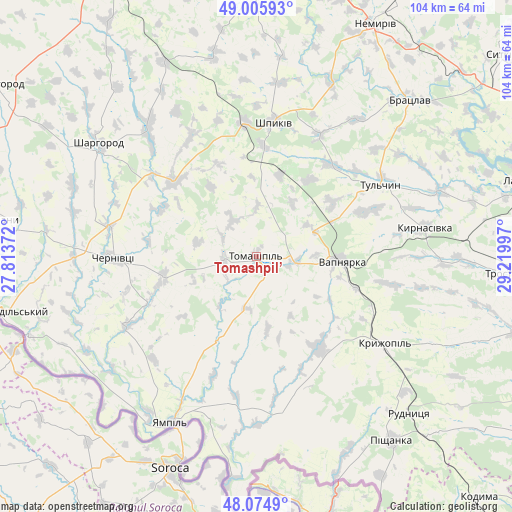
Tomashpil’ GPS coordinates[2]
48° 32' 33.216" North, 28° 31' 0.624" East
| Map corner | latitude | longitude |
|---|---|---|
| Upper-left | 49.00593°, | 27.81372° |
| Center: | 48.54256°, | 28.51684° |
| Lower-right: | 48.0749°, | 29.21997° |
| Map W x H: | 103.5×103.5 km | = 64.3×64.3mi |
| max Lat: | 52.18903° ⇑43.5% North |
| Tomashpil’: | 48.54256° |
| min Lat: | ⇓56.5% South 44.39214° |
| min Long | Tomashpil’ | max Long |
| 22.20555° | 28.51684° | 40.13222° |
| W 25.4%⇐ | ⇒74.6% E |
Elevation
Elevation of Tomashpil’ is 240 m = 787 ft, and this is 84.2 m = 276 ft above average elevation for this country.
| Max E: |
886 m = 2907 ft | 21.7% |
| Tomashpil’ | 240 m 787 ft | |
| Avg. | 155.8 m = 511 ft | |
Min E: |
-3 m = -10 ft | 78.3% |
See also: Ukraine elevation on elevation.city.
Geographical zone
Tomashpil’ is located in North temperate zone (between Tropic of Cancer and the Arctic Circle). Distance of this North polar circle is 2003.7 km =1245 mi to North.| Distance of | km | miles | from Tomashpil’ |
|---|---|---|---|
| North Pole | 4609.6 | 2864.3 | to North |
| Arctic Circle | 2003.7 | 1245 | to North |
| Tropic Cancer | 2791.5 | 1734.6 | to South |
| Equator | 5397.4 | 3353.8 | to South |


Nearby cities:
15 places around Tomashpil’: (largest is in red/bold)
• Bratslav
44 km =27.3 mi,  44°
44°
• Chernivtsi
29.6 km =18.4 mi,  269°
269°
• Klembivka
18.6 km =11.6 mi,  204°
204°
• Kryzhopil’
31.3 km =19.4 mi,  124°
124°
• Murafa
33.4 km =20.8 mi,  318°
318°
• Nemyriv
53.1 km =33 mi,  26°
26°
• Pishchanka
46.2 km =28.7 mi,  143°
143°
• Sharhorod
40.2 km =25 mi,  306°
306°
• Torkanivka
52.5 km =32.6 mi, 117°
• Trostyanets’
53 km =32.9 mi,  93°
93°
• Tsybulevka
46.5 km =28.9 mi,  111°
111°
• Tulchyn
28.3 km =17.6 mi,  58°
58°
• Tyvriv
52.4 km =32.6 mi,  359°
359°
• Vapnyarka
16.7 km =10.4 mi, 92°
• Yampil’
37.6 km =23.4 mi,  207°
207°
Sources, notices
• [Note1] Compared only with cities in Ukraine existing in our database
• [Src1] Map data: © OpenStreetMap contributors (CC-BY-SA)
• [Src2] Other city data from geonames.org with taken over terms of usage.
• [Src3] Geographical zone / Annual Mean Temperature by Robert A. Rohde @ Wikipedia
