Podil’s’k geodata
Podil’s’k (Odesa) is a seat of a second-order administrative division; located in Ukraine in Europe/Kiev (GMT+3) time zone. With population of 40,664 people, there are 111 cities with bigger population in this country. Compared to other cities in Ukraine, 58.8% of cities are located further ↑North; 70.1% of cities are located further →East and 78.8% of cities have lower elevation than Podil’s’k. Note1


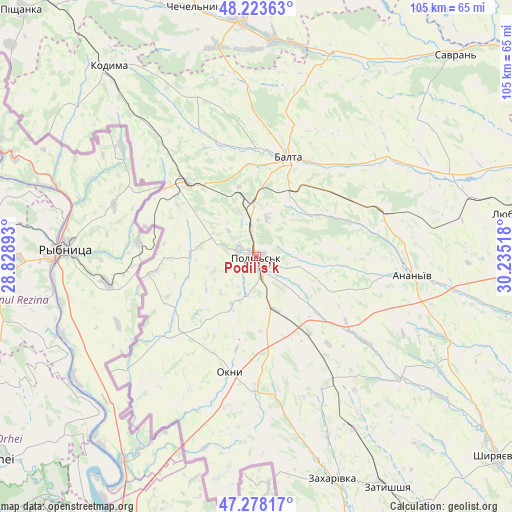
Podil’s’k GPS coordinates[2]
47° 45' 10.98" North, 29° 31' 55.38" East
| Map corner | latitude | longitude |
|---|---|---|
| Upper-left | 48.22363°, | 28.82893° |
| Center: | 47.75305°, | 29.53205° |
| Lower-right: | 47.27817°, | 30.23518° |
| Map W x H: | 105.1×105.1 km | = 65.3×65.3mi |
| max Lat: | 52.18903° ⇑58.8% North |
| Podil’s’k: | 47.75305° |
| min Lat: | ⇓41.2% South 44.39214° |
| min Long | Podil’s’k | max Long |
| 22.20555° | 29.53205° | 40.13222° |
| W 29.9%⇐ | ⇒70.1% E |
Elevation
Elevation of Podil’s’k is 241 m = 791 ft, and this is 85.2 m = 280 ft above average elevation for this country.
| Max E: |
886 m = 2907 ft | 21.2% |
| Podil’s’k | 241 m 791 ft | |
| Avg. | 155.8 m = 511 ft | |
Min E: |
-3 m = -10 ft | 78.8% |
See also: Podil’s’k elevation on elevation.city.
Geographical zone
Podil’s’k is located in North temperate zone (between Tropic of Cancer and the Arctic Circle). Distance of this North polar circle is 2091.5 km =1299.6 mi to North.| Distance of | km | miles | from Podil’s’k |
|---|---|---|---|
| North Pole | 4697.4 | 2918.8 | to North |
| Arctic Circle | 2091.5 | 1299.6 | to North |
| Tropic Cancer | 2703.7 | 1680 | to South |
| Equator | 5309.6 | 3299.2 | to South |


Nearby cities:
15 places around Podil’s’k: (largest is in red/bold)
• Ananyiv Pershyi
31.1 km =19.3 mi,  96°
96°
• Balta
21.3 km =13.2 mi,  17°
17°
• Chechelnyk
52.8 km =32.8 mi,  346°
346°
• Kodyma
49 km =30.4 mi,  321°
321°
• Lyubashivka
55.2 km =34.3 mi,  80°
80°
• Mayaky
34.8 km =21.6 mi,  176°
176°
• Okny
24.2 km =15 mi,  192°
192°
• Peschana
44.4 km =27.6 mi, 19°
• Savran
58.8 km =36.5 mi,  44°
44°
• Shyryayeve
64.8 km =40.3 mi,  129°
129°
• Slobidka
20.4 km =12.7 mi, 317°
• Zagnitkiv
57.9 km =36 mi,  304°
304°
• Zakharivka
49.8 km =30.9 mi,  159°
159°
• Zatyshshya
53.2 km =33.1 mi,  151°
151°
• Zavallya
62.6 km =38.9 mi, 35°
Sources, notices
• [Note1] Compared only with cities in Ukraine existing in our database
• [Src1] Map data: © OpenStreetMap contributors (CC-BY-SA)
• [Src2] Other city data from geonames.org with taken over terms of usage.
• [Src3] Geographical zone / Annual Mean Temperature by Robert A. Rohde @ Wikipedia
