Kolomak geodata
Kolomak (Kharkiv) is a seat of a second-order administrative division; located in Ukraine in Europe/Kiev (GMT+3) time zone. With population of 3,712 people, there are 797 cities with bigger population in this country. Compared to other cities in Ukraine, 80.7% of cities are located further ↓South; 83.3% of cities are located further ←West and 56.9% of cities have higher elevation than Kolomak. Note1


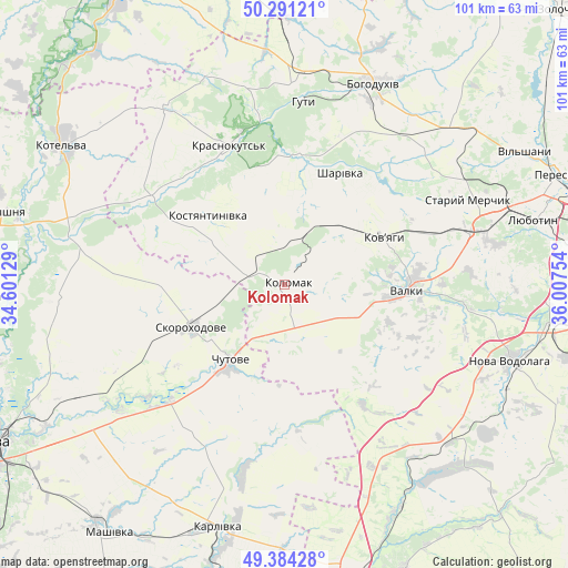
Kolomak GPS coordinates[2]
49° 50' 23.532" North, 35° 18' 15.876" East
| Map corner | latitude | longitude |
|---|---|---|
| Upper-left | 50.29121°, | 34.60129° |
| Center: | 49.83987°, | 35.30441° |
| Lower-right: | 49.38428°, | 36.00754° |
| Map W x H: | 100.8×100.8 km | = 62.6×62.6mi |
| max Lat: | 52.18903° ⇑19.3% North |
| Kolomak: | 49.83987° |
| min Lat: | ⇓80.7% South 44.39214° |
| min Long | Kolomak | max Long |
| 22.20555° | 35.30441° | 40.13222° |
| W 83.3%⇐ | ⇒16.7% E |
Elevation
Elevation of Kolomak is 115 m = 377 ft, and this is 40.8 m = 134 ft below average elevation for this country.
| Max E: |
886 m = 2907 ft | 56.9% |
| Avg. | 155.8 m = 511 ft | |
| Kolomak | 115 m = 377 ft | |
Min E: |
-3 m = -10 ft | 43.1% |
See also: Ukraine elevation on elevation.city.
Geographical zone
Kolomak is located in North temperate zone (between Tropic of Cancer and the Arctic Circle). Distance of this North polar circle is 1859.5 km =1155.4 mi to North.| Distance of | km | miles | from Kolomak |
|---|---|---|---|
| North Pole | 4465.4 | 2774.7 | to North |
| Arctic Circle | 1859.5 | 1155.4 | to North |
| Tropic Cancer | 2935.8 | 1824.2 | to South |
| Equator | 5541.7 | 3443.5 | to South |


Nearby cities:
15 places around Kolomak: (largest is in red/bold)
• Bohodukhiv
39.5 km =24.5 mi,  23°
23°
• Chutove
17.5 km =10.9 mi,  214°
214°
• Huty
32.7 km =20.3 mi,  4°
4°
• Karlivka
44.4 km =27.6 mi,  196°
196°
• Kotel’va
46.6 km =29 mi,  303°
303°
• Krasnokuts’k
27.1 km =16.8 mi,  338°
338°
• Lyubotyn
46.3 km =28.8 mi,  75°
75°
• Manchenky
42.6 km =26.5 mi,  68°
68°
• Nova Vodolaha
42.5 km =26.4 mi,  108°
108°
• Oposhnya
51.2 km =31.8 mi,  284°
284°
• Shlyakh
34.2 km =21.3 mi, 74°
• Staryy Merchyk
36.2 km =22.5 mi,  64°
64°
• Valky
22.1 km =13.7 mi,  91°
91°
• Varvarivka
34.4 km =21.4 mi,  192°
192°
• Verbivka
49.9 km =31 mi,  160°
160°
Sources, notices
• [Note1] Compared only with cities in Ukraine existing in our database
• [Src1] Map data: © OpenStreetMap contributors (CC-BY-SA)
• [Src2] Other city data from geonames.org with taken over terms of usage.
• [Src3] Geographical zone / Annual Mean Temperature by Robert A. Rohde @ Wikipedia
