Horishni Plavni geodata
Horishni Plavni (Poltava) is a seat of a second-order administrative division; located in Ukraine in Europe/Kiev (GMT+3) time zone. With population of 51,740 people, there are 91 cities with bigger population in this country. Compared to other cities in Ukraine, 66.4% of cities are located further ↓South; 54.3% of cities are located further ←West and 72.2% of cities have higher elevation than Horishni Plavni. Note1


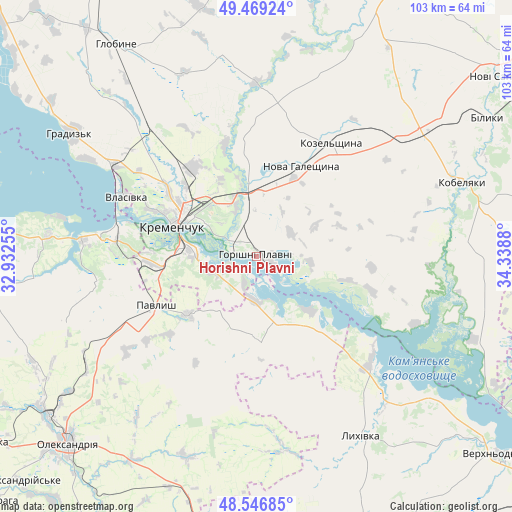
Horishni Plavni GPS coordinates[2]
49° 0' 36.648" North, 33° 38' 8.412" East
| Map corner | latitude | longitude |
|---|---|---|
| Upper-left | 49.46924°, | 32.93255° |
| Center: | 49.01018°, | 33.63567° |
| Lower-right: | 48.54685°, | 34.3388° |
| Map W x H: | 102.6×102.6 km | = 63.8×63.8mi |
| max Lat: | 52.18903° ⇑33.6% North |
| Horishni Plavni: | 49.01018° |
| min Lat: | ⇓66.4% South 44.39214° |
| min Long | Horishni Plavni | max Long |
| 22.20555° | 33.63567° | 40.13222° |
| W 54.3%⇐ | ⇒45.7% E |
Elevation
Elevation of Horishni Plavni is 69 m = 226 ft, and this is 86.8 m = 285 ft below average elevation for this country.
| Max E: |
886 m = 2907 ft | 72.2% |
| Avg. | 155.8 m = 511 ft | |
| Horishni Plavni | 69 m = 226 ft | |
Min E: |
-3 m = -10 ft | 27.8% |
See also: Horishni Plavni elevation on elevation.city.
Geographical zone
Horishni Plavni is located in North temperate zone (between Tropic of Cancer and the Arctic Circle). Distance of this North polar circle is 1951.8 km =1212.8 mi to North.| Distance of | km | miles | from Horishni Plavni |
|---|---|---|---|
| North Pole | 4557.6 | 2832 | to North |
| Arctic Circle | 1951.8 | 1212.8 | to North |
| Tropic Cancer | 2843.5 | 1766.9 | to South |
| Equator | 5449.4 | 3386.1 | to South |


Nearby cities:
15 places around Horishni Plavni: (largest is in red/bold)
• Hlobyne
50.1 km =31.1 mi,  326°
326°
• Hradyz’k
44.1 km =27.4 mi,  304°
304°
• Kamennyye Potoki
8.7 km =5.4 mi,  246°
246°
• Kobelyaky
43.7 km =27.2 mi,  69°
69°
• Kozel’shchyna
27.7 km =17.2 mi,  33°
33°
• Kremenchuk
17 km =10.6 mi,  292°
292°
• Lutovynivka
32 km =19.9 mi,  37°
37°
• Lykhivka
41.6 km =25.8 mi,  149°
149°
• Novi Sanzhary
61.5 km =38.2 mi,  52°
52°
• Oleksandriya
53.7 km =33.4 mi,  225°
225°
• Onufriyivka
17.8 km =11.1 mi, 229°
• Pavlysh
22.8 km =14.2 mi,  243°
243°
• Pryyutivka
52.4 km =32.6 mi, 232°
• Svitlovods’k
29.1 km =18.1 mi,  278°
278°
• Tsarychanka
62.1 km =38.6 mi,  97°
97°
In other languages:
- In France: Horichni Plavni
- In Italian: Komsomol'sk
- In Russian: Горишние Плавни
- In Chinese: 共青城
Sources, notices
• [Note1] Compared only with cities in Ukraine existing in our database
• [Src1] Map data: © OpenStreetMap contributors (CC-BY-SA)
• [Src2] Other city data from geonames.org with taken over terms of usage.
• [Src3] Geographical zone / Annual Mean Temperature by Robert A. Rohde @ Wikipedia
