Zastavna geodata
Zastavna (Chernivtsi Oblast') is a seat of a second-order administrative division; located in Ukraine in Europe/Kiev (GMT+3) time zone. With population of 8,536 people, there are 417 cities with bigger population in this country. Compared to other cities in Ukraine, 55.8% of cities are located further ↓South; 81.5% of cities are located further →East and 78% of cities have lower elevation than Zastavna. Note1


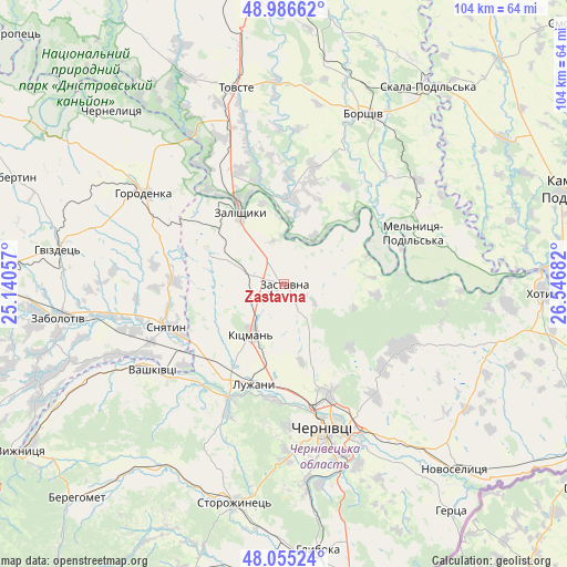
Zastavna GPS coordinates[2]
48° 31' 23.052" North, 25° 50' 37.284" East
| Map corner | latitude | longitude |
|---|---|---|
| Upper-left | 48.98662°, | 25.14057° |
| Center: | 48.52307°, | 25.84369° |
| Lower-right: | 48.05524°, | 26.54682° |
| Map W x H: | 103.6×103.6 km | = 64.4×64.4mi |
| max Lat: | 52.18903° ⇑44.2% North |
| Zastavna: | 48.52307° |
| min Lat: | ⇓55.8% South 44.39214° |
| min Long | Zastavna | max Long |
| 22.20555° | 25.84369° | 40.13222° |
| W 18.5%⇐ | ⇒81.5% E |
Elevation
Elevation of Zastavna is 239 m = 784 ft, and this is 83.2 m = 273 ft above average elevation for this country.
| Max E: |
886 m = 2907 ft | 22% |
| Zastavna | 239 m 784 ft | |
| Avg. | 155.8 m = 511 ft | |
Min E: |
-3 m = -10 ft | 78% |
See also: Ukraine elevation on elevation.city.
Geographical zone
Zastavna is located in North temperate zone (between Tropic of Cancer and the Arctic Circle). Distance of this North polar circle is 2005.9 km =1246.4 mi to North.| Distance of | km | miles | from Zastavna |
|---|---|---|---|
| North Pole | 4611.8 | 2865.6 | to North |
| Arctic Circle | 2005.9 | 1246.4 | to North |
| Tropic Cancer | 2789.3 | 1733.2 | to South |
| Equator | 5395.3 | 3352.5 | to South |


Nearby cities:
15 places around Zastavna: (largest is in red/bold)
• Borshchiv
34.4 km =21.4 mi,  25°
25°
• Chernivtsi
26.7 km =16.6 mi,  164°
164°
• Chernyatyn
32.8 km =20.4 mi,  297°
297°
• Horodenka
30.2 km =18.8 mi, 303°
• Kadubivtsi
8.7 km =5.4 mi,  320°
320°
• Kitsman’
10.5 km =6.5 mi,  212°
212°
• Klishkivtsi
32.5 km =20.2 mi,  108°
108°
• Kostryzhivka
17.5 km =10.9 mi,  326°
326°
• Luzhany
18.4 km =11.4 mi,  196°
196°
• Shypyntsi
17.8 km =11.1 mi, 203°
• Sniatyn
21.9 km =13.6 mi,  247°
247°
• Stetseva
19.7 km =12.2 mi,  271°
271°
• Vashkivtsi
29 km =18 mi,  238°
238°
• Verenchanka
7.7 km =4.8 mi,  289°
289°
• Zalishchyky
15.5 km =9.6 mi, 329°
Sources, notices
• [Note1] Compared only with cities in Ukraine existing in our database
• [Src1] Map data: © OpenStreetMap contributors (CC-BY-SA)
• [Src2] Other city data from geonames.org with taken over terms of usage.
• [Src3] Geographical zone / Annual Mean Temperature by Robert A. Rohde @ Wikipedia
