Hlobyne geodata
Hlobyne (Poltava) is a seat of a second-order administrative division; located in Ukraine in Europe/Kiev (GMT+3) time zone. With population of 12,544 people, there are 299 cities with bigger population in this country. Compared to other cities in Ukraine, 72.5% of cities are located further ↓South; 50.8% of cities are located further →East and 63.5% of cities have higher elevation than Hlobyne. Note1


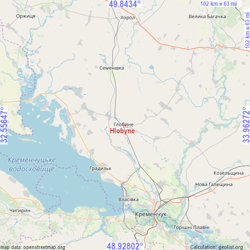
Hlobyne GPS coordinates[2]
49° 23' 16.224" North, 33° 15' 34.524" East
| Map corner | latitude | longitude |
|---|---|---|
| Upper-left | 49.8434°, | 32.55647° |
| Center: | 49.38784°, | 33.25959° |
| Lower-right: | 48.92802°, | 33.96272° |
| Map W x H: | 101.8×101.8 km | = 63.3×63.3mi |
| max Lat: | 52.18903° ⇑27.5% North |
| Hlobyne: | 49.38784° |
| min Lat: | ⇓72.5% South 44.39214° |
| min Long | Hlobyne | max Long |
| 22.20555° | 33.25959° | 40.13222° |
| W 49.2%⇐ | ⇒50.8% E |
Elevation
Elevation of Hlobyne is 95 m = 312 ft, and this is 60.8 m = 199 ft below average elevation for this country.
| Max E: |
886 m = 2907 ft | 63.5% |
| Avg. | 155.8 m = 511 ft | |
| Hlobyne | 95 m = 312 ft | |
Min E: |
-3 m = -10 ft | 36.5% |
See also: Ukraine elevation on elevation.city.
Geographical zone
Hlobyne is located in North temperate zone (between Tropic of Cancer and the Arctic Circle). Distance of this North polar circle is 1909.8 km =1186.7 mi to North.| Distance of | km | miles | from Hlobyne |
|---|---|---|---|
| North Pole | 4515.6 | 2805.9 | to North |
| Arctic Circle | 1909.8 | 1186.7 | to North |
| Tropic Cancer | 2885.5 | 1793 | to South |
| Equator | 5491.4 | 3412.2 | to South |


Nearby cities:
15 places around Hlobyne: (largest is in red/bold)
• Chyhyryn
55.4 km =34.4 mi,  232°
232°
• Horishni Plavni
50.1 km =31.1 mi,  146°
146°
• Hradyz’k
19.2 km =11.9 mi,  207°
207°
• Kamennyye Potoki
49.3 km =30.6 mi,  156°
156°
• Khorol
44 km =27.3 mi,  1°
1°
• Kozel’shchyna
46.7 km =29 mi,  114°
114°
• Kremenchuk
37.4 km =23.2 mi, 161°
• Lutovynivka
49.7 km =30.9 mi, 109°
• Onufriyivka
55.2 km =34.3 mi,  165°
165°
• Orzhytsya
60.3 km =37.5 mi,  317°
317°
• Pavlysh
52.8 km =32.8 mi, 172°
• Reshetylivka
62.3 km =38.7 mi,  71°
71°
• Semenivka
23.2 km =14.4 mi,  345°
345°
• Svitlovods’k
37.7 km =23.4 mi,  182°
182°
• Velyka Bahachka
55.9 km =34.7 mi,  36°
36°
Sources, notices
• [Note1] Compared only with cities in Ukraine existing in our database
• [Src1] Map data: © OpenStreetMap contributors (CC-BY-SA)
• [Src2] Other city data from geonames.org with taken over terms of usage.
• [Src3] Geographical zone / Annual Mean Temperature by Robert A. Rohde @ Wikipedia
