Semenivka geodata
Semenivka (Poltava) is a seat of a second-order administrative division; located in Ukraine in Europe/Kiev (GMT+3) time zone. With population of 7,305 people, there are 489 cities with bigger population in this country. Compared to other cities in Ukraine, 76% of cities are located further ↓South; 51.6% of cities are located further →East and 64.7% of cities have higher elevation than Semenivka. Note1


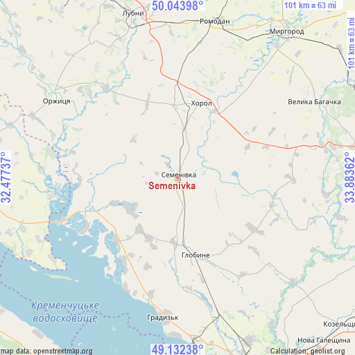
Semenivka GPS coordinates[2]
49° 35' 25.116" North, 33° 10' 49.764" East
| Map corner | latitude | longitude |
|---|---|---|
| Upper-left | 50.04398°, | 32.47737° |
| Center: | 49.59031°, | 33.18049° |
| Lower-right: | 49.13238°, | 33.88362° |
| Map W x H: | 101.4×101.4 km | = 63×63mi |
| max Lat: | 52.18903° ⇑24% North |
| Semenivka: | 49.59031° |
| min Lat: | ⇓76% South 44.39214° |
| min Long | Semenivka | max Long |
| 22.20555° | 33.18049° | 40.13222° |
| W 48.4%⇐ | ⇒51.6% E |
Elevation
Elevation of Semenivka is 92 m = 302 ft, and this is 63.8 m = 209 ft below average elevation for this country.
| Max E: |
886 m = 2907 ft | 64.7% |
| Avg. | 155.8 m = 511 ft | |
| Semenivka | 92 m = 302 ft | |
Min E: |
-3 m = -10 ft | 35.3% |
See also: Ukraine elevation on elevation.city.
Geographical zone
Semenivka is located in North temperate zone (between Tropic of Cancer and the Arctic Circle). Distance of this North polar circle is 1887.2 km =1172.7 mi to North.| Distance of | km | miles | from Semenivka |
|---|---|---|---|
| North Pole | 4493.1 | 2791.9 | to North |
| Arctic Circle | 1887.2 | 1172.7 | to North |
| Tropic Cancer | 2908 | 1806.9 | to South |
| Equator | 5513.9 | 3426.2 | to South |


Nearby cities:
15 places around Semenivka: (largest is in red/bold)
• Chornobay
61.9 km =38.5 mi,  277°
277°
• Hlobyne
23.2 km =14.4 mi,  165°
165°
• Hradyz’k
39.7 km =24.7 mi,  184°
184°
• Khorol
22.6 km =14 mi,  18°
18°
• Kozel’shchyna
63.7 km =39.6 mi,  130°
130°
• Kremenchuk
60.6 km =37.7 mi,  163°
163°
• Lubny
49.2 km =30.6 mi,  344°
344°
• Lutovynivka
65.5 km =40.7 mi, 126°
• Myrhorod
52.1 km =32.4 mi,  36°
36°
• Orzhytsya
41.1 km =25.5 mi,  302°
302°
• Reshetylivka
64.8 km =40.3 mi,  92°
92°
• Romodan
45.7 km =28.4 mi,  13°
13°
• Shyshaky
67.9 km =42.2 mi,  61°
61°
• Svitlovods’k
60.4 km =37.5 mi, 175°
• Velyka Bahachka
44.9 km =27.9 mi, 60°
Sources, notices
• [Note1] Compared only with cities in Ukraine existing in our database
• [Src1] Map data: © OpenStreetMap contributors (CC-BY-SA)
• [Src2] Other city data from geonames.org with taken over terms of usage.
• [Src3] Geographical zone / Annual Mean Temperature by Robert A. Rohde @ Wikipedia
