Dashiv geodata
Dashiv (Vinnyts'ka) is a populated place; located in Ukraine in Europe/Kiev (GMT+3) time zone. With population of 4,233 people, there are 733 cities with bigger population in this country. Compared to other cities in Ukraine, 66.2% of cities are located further ↓South; 70.7% of cities are located further →East and 67.1% of cities have lower elevation than Dashiv. Note1


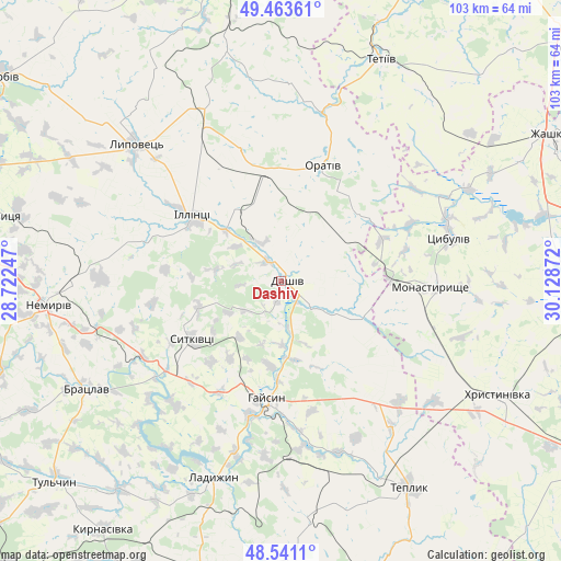
Dashiv GPS coordinates[2]
49° 0' 16.164" North, 29° 25' 32.124" East
| Map corner | latitude | longitude |
|---|---|---|
| Upper-left | 49.46361°, | 28.72247° |
| Center: | 49.00449°, | 29.42559° |
| Lower-right: | 48.5411°, | 30.12872° |
| Map W x H: | 102.6×102.6 km | = 63.8×63.8mi |
| max Lat: | 52.18903° ⇑33.8% North |
| Dashiv: | 49.00449° |
| min Lat: | ⇓66.2% South 44.39214° |
| min Long | Dashiv | max Long |
| 22.20555° | 29.42559° | 40.13222° |
| W 29.3%⇐ | ⇒70.7% E |
Elevation
Elevation of Dashiv is 194 m = 636 ft, and this is 38.2 m = 125 ft above average elevation for this country.
| Max E: |
886 m = 2907 ft | 32.9% |
| Dashiv | 194 m 636 ft | |
| Avg. | 155.8 m = 511 ft | |
Min E: |
-3 m = -10 ft | 67.1% |
See also: Ukraine elevation on elevation.city.
Geographical zone
Dashiv is located in North temperate zone (between Tropic of Cancer and the Arctic Circle). Distance of this North polar circle is 1952.4 km =1213.2 mi to North.| Distance of | km | miles | from Dashiv |
|---|---|---|---|
| North Pole | 4558.3 | 2832.4 | to North |
| Arctic Circle | 1952.4 | 1213.2 | to North |
| Tropic Cancer | 2842.9 | 1766.5 | to South |
| Equator | 5448.8 | 3385.7 | to South |


Nearby cities:
15 places around Dashiv: (largest is in red/bold)
• Bratslav
40.8 km =25.4 mi,  240°
240°
• Haisyn
21.6 km =13.4 mi,  186°
186°
• Illintsi
18.8 km =11.7 mi,  306°
306°
• Khrystynivka
45.4 km =28.2 mi,  117°
117°
• Ladyzhyn
38.1 km =23.7 mi,  201°
201°
• Lypovets
36.8 km =22.9 mi, 312°
• Monastyryshche
27.7 km =17.2 mi,  93°
93°
• Nemyriv
43.1 km =26.8 mi,  265°
265°
• Nove-Misto
29.5 km =18.3 mi,  95°
95°
• Orativ
21.8 km =13.5 mi,  19°
19°
• Pohrebyshche
54.9 km =34.1 mi,  347°
347°
• Teplyk
44.3 km =27.5 mi,  148°
148°
• Tetiiv
44.9 km =27.9 mi, 22°
• Tsibulev
31.8 km =19.8 mi,  74°
74°
• Verkhniachka
48.9 km =30.4 mi,  113°
113°
Sources, notices
• [Note1] Compared only with cities in Ukraine existing in our database
• [Src1] Map data: © OpenStreetMap contributors (CC-BY-SA)
• [Src2] Other city data from geonames.org with taken over terms of usage.
• [Src3] Geographical zone / Annual Mean Temperature by Robert A. Rohde @ Wikipedia
