Four Bears Village geodata
Four Bears Village (North Dakota) is a populated place; located in United States in America/Chicago (GMT-5) time zone. With population of 517 people, there are 20672 cities with bigger population in this country. Compared to other cities in United States, 98.6% of cities are located further ↓South; 82.1% of cities are located further →East and 89.5% of cities have lower elevation than Four Bears Village. Note1
Administrative division(s):
- Level 1: North Dakota
- Level 2: McKenzie County
- Level 3: Unorganized Territory of Fort Berthold


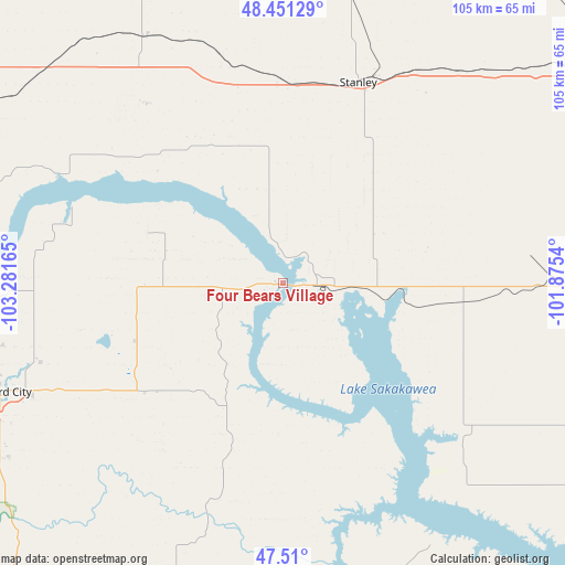
Four Bears Village GPS coordinates[2]
47° 58' 58.044" North, 102° 34' 42.672" West
| Map corner | latitude | longitude |
|---|---|---|
| Upper-left | 48.45129°, | -103.28165° |
| Center: | 47.98279°, | -102.57852° |
| Lower-right: | 47.51°, | -101.8754° |
| Map W x H: | 104.7×104.7 km | = 65.1×65.1mi |
| max Lat: | 71.29058° ⇑1.4% North |
| Four Bears Village: | 47.98279° |
| min Lat: | ⇓98.6% South 19.06759° |
| min Long | Four Bears Vill | max Long |
| -171.73463° | -102.57852° | -66.98998° |
| W 17.9%⇐ | ⇒82.1% E |
Elevation
Elevation of Four Bears Village is 590 m = 1936 ft, and this is 295.2 m = 969 ft above average elevation for this country.
| Max E: |
3189 m = 10463 ft | 10.5% |
| Four Bears Village | 590 m 1936 ft | |
| Avg. | 294.8 m = 967 ft | |
Min E: |
-60 m = -197 ft | 89.5% |
See also: United States elevation on elevation.city.
Geographical zone
Four Bears Village is located in North temperate zone (between Tropic of Cancer and the Arctic Circle). Distance of this North polar circle is 2066 km =1283.8 mi to North.| Distance of | km | miles | from Four Bears Village |
|---|---|---|---|
| North Pole | 4671.9 | 2903 | to North |
| Arctic Circle | 2066 | 1283.8 | to North |
| Tropic Cancer | 2729.3 | 1695.9 | to South |
| Equator | 5335.2 | 3315.1 | to South |


Nearby cities:
15 places around Four Bears Village: (largest is in red/bold)
• Berthold
72.4 km =45 mi,  59°
59°
• Bowbells
94.5 km =58.7 mi,  15°
15°
• Burlington
91.3 km =56.7 mi,  69°
69°
• Garrison
94.3 km =58.6 mi,  112°
112°
• Kenmare
85.2 km =52.9 mi,  25°
25°
• Killdeer
69.2 km =43 mi,  190°
190°
• Mandaree
29.1 km =18.1 mi, 194°
• Manning
84.9 km =52.8 mi, 189°
• New Town
6.6 km =4.1 mi,  91°
91°
• Parshall
33.2 km =20.6 mi,  95°
95°
• Ray
59.2 km =36.8 mi,  312°
312°
• Stanley
39.7 km =24.7 mi, 20°
• Tioga
53.2 km =33.1 mi,  329°
329°
• Watford City
56.2 km =34.9 mi,  249°
249°
• Williston
79.4 km =49.3 mi,  283°
283°
Sources, notices
• [Note1] Compared only with cities in United States existing in our database
• [Src1] Map data: © OpenStreetMap contributors (CC-BY-SA)
• [Src2] Other city data from geonames.org with taken over terms of usage.
• [Src3] Geographical zone / Annual Mean Temperature by Robert A. Rohde @ Wikipedia
