Berthold geodata
Berthold (North Dakota) is a populated place; located in United States in America/Chicago (GMT-5) time zone. With population of 501 people, there are 20887 cities with bigger population in this country. Compared to other cities in United States, 99% of cities are located further ↓South; 81.7% of cities are located further →East and 90.2% of cities have lower elevation than Berthold. Note1


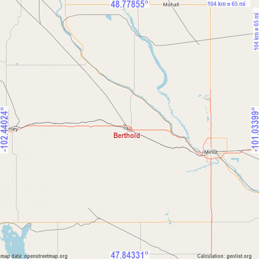
Berthold GPS coordinates[2]
48° 18' 47.052" North, 101° 44' 13.596" West
| Map corner | latitude | longitude |
|---|---|---|
| Upper-left | 48.77855°, | -102.44024° |
| Center: | 48.31307°, | -101.73711° |
| Lower-right: | 47.84331°, | -101.03399° |
| Map W x H: | 104×104 km | = 64.6×64.6mi |
| max Lat: | 71.29058° ⇑1% North |
| Berthold: | 48.31307° |
| min Lat: | ⇓99% South 19.06759° |
| min Long | Berthold | max Long |
| -171.73463° | -101.73711° | -66.98998° |
| W 18.3%⇐ | ⇒81.7% E |
Elevation
Elevation of Berthold is 636 m = 2087 ft, and this is 341.2 m = 1119 ft above average elevation for this country.
| Max E: |
3189 m = 10463 ft | 9.8% |
| Berthold | 636 m 2087 ft | |
| Avg. | 294.8 m = 967 ft | |
Min E: |
-60 m = -197 ft | 90.2% |
See also: United States elevation on elevation.city.
Geographical zone
Berthold is located in North temperate zone (between Tropic of Cancer and the Arctic Circle). Distance of this North polar circle is 2029.3 km =1260.9 mi to North.| Distance of | km | miles | from Berthold |
|---|---|---|---|
| North Pole | 4635.2 | 2880.2 | to North |
| Arctic Circle | 2029.3 | 1260.9 | to North |
| Tropic Cancer | 2766 | 1718.7 | to South |
| Equator | 5371.9 | 3337.9 | to South |


Nearby cities:
15 places around Berthold: (largest is in red/bold)
• Bowbells
66.1 km =41.1 mi,  325°
325°
• Burlington
23.2 km =14.4 mi,  100°
100°
• Four Bears Village
72.4 km =45 mi,  239°
239°
• Garrison
77.3 km =48 mi,  161°
161°
• Kenmare
47.6 km =29.6 mi, 327°
• Mandaree
95.3 km =59.2 mi,  227°
227°
• Minot
33.8 km =21 mi,  105°
105°
• Minot Air Force Base
31.7 km =19.7 mi,  67°
67°
• Mohall
52.7 km =32.7 mi,  18°
18°
• New Town
67 km =41.6 mi, 236°
• Parshall
49.7 km =30.9 mi,  216°
216°
• Stanley
48.3 km =30 mi,  270°
270°
• Surrey
45.5 km =28.3 mi, 100°
• Tioga
89.2 km =55.4 mi,  276°
276°
• Velva
66.4 km =41.3 mi,  115°
115°
Sources, notices
• [Note1] Compared only with cities in United States existing in our database
• [Src1] Map data: © OpenStreetMap contributors (CC-BY-SA)
• [Src2] Other city data from geonames.org with taken over terms of usage.
• [Src3] Geographical zone / Annual Mean Temperature by Robert A. Rohde @ Wikipedia
