Velva geodata
Velva (North Dakota) is a populated place; located in United States in America/Chicago (GMT-5) time zone. With population of 1,260 people, there are 14793 cities with bigger population in this country. Compared to other cities in United States, 98.7% of cities are located further ↓South; 81.3% of cities are located further →East and 86.8% of cities have lower elevation than Velva. Note1


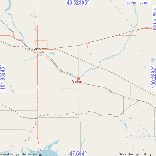
Velva GPS coordinates[2]
48° 3' 22.032" North, 100° 55' 45.552" West
| Map corner | latitude | longitude |
|---|---|---|
| Upper-left | 48.52395°, | -101.63245° |
| Center: | 48.05612°, | -100.92932° |
| Lower-right: | 47.584°, | -100.2262° |
| Map W x H: | 104.5×104.5 km | = 64.9×64.9mi |
| max Lat: | 71.29058° ⇑1.3% North |
| Velva: | 48.05612° |
| min Lat: | ⇓98.7% South 19.06759° |
| min Long | Velva | max Long |
| -171.73463° | -100.92932° | -66.98998° |
| W 18.7%⇐ | ⇒81.3% E |
Elevation
Elevation of Velva is 464 m = 1522 ft, and this is 169.2 m = 555 ft above average elevation for this country.
| Max E: |
3189 m = 10463 ft | 13.2% |
| Velva | 464 m 1522 ft | |
| Avg. | 294.8 m = 967 ft | |
Min E: |
-60 m = -197 ft | 86.8% |
See also: United States elevation on elevation.city.
Geographical zone
Velva is located in North temperate zone (between Tropic of Cancer and the Arctic Circle). Distance of this North polar circle is 2057.8 km =1278.7 mi to North.| Distance of | km | miles | from Velva |
|---|---|---|---|
| North Pole | 4663.7 | 2897.9 | to North |
| Arctic Circle | 2057.8 | 1278.7 | to North |
| Tropic Cancer | 2737.4 | 1700.9 | to South |
| Equator | 5343.3 | 3320.2 | to South |


Nearby cities:
15 places around Velva: (largest is in red/bold)
• Berthold
66.4 km =41.3 mi,  295°
295°
• Burlington
44.3 km =27.5 mi, 303°
• Garrison
57.7 km =35.9 mi,  218°
218°
• Harvey
80.6 km =50.1 mi,  113°
113°
• McClusky
73.1 km =45.4 mi,  150°
150°
• Minot
33.6 km =20.9 mi,  305°
305°
• Minot Air Force Base
50.7 km =31.5 mi,  323°
323°
• Mohall
89.7 km =55.7 mi,  331°
331°
• Rugby
77.4 km =48.1 mi,  63°
63°
• Stanton
88.5 km =55 mi,  202°
202°
• Surrey
25.1 km =15.6 mi, 322°
• Towner
50.4 km =31.3 mi,  50°
50°
• Turtle Lake
59.7 km =37.1 mi,  177°
177°
• Underwood
68.5 km =42.6 mi,  193°
193°
• Washburn
85.6 km =53.2 mi, 185°
Sources, notices
• [Note1] Compared only with cities in United States existing in our database
• [Src1] Map data: © OpenStreetMap contributors (CC-BY-SA)
• [Src2] Other city data from geonames.org with taken over terms of usage.
• [Src3] Geographical zone / Annual Mean Temperature by Robert A. Rohde @ Wikipedia
