Minot geodata
Minot (North Dakota) is a seat of a second-order administrative division; located in United States in America/Chicago (GMT-5) time zone. With population of 49,450 people, there are 965 cities with bigger population in this country. Compared to other cities in United States, 98.9% of cities are located further ↓South; 81.4% of cities are located further →East and 87.6% of cities have lower elevation than Minot. Note1


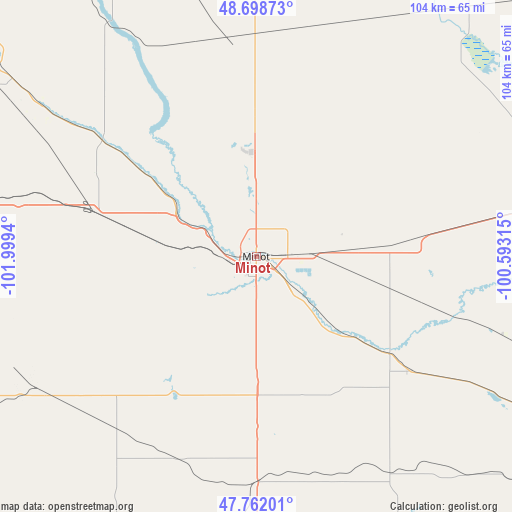
Minot GPS coordinates[2]
48° 13' 57.036" North, 101° 17' 46.572" West
| Map corner | latitude | longitude |
|---|---|---|
| Upper-left | 48.69873°, | -101.9994° |
| Center: | 48.23251°, | -101.29627° |
| Lower-right: | 47.76201°, | -100.59315° |
| Map W x H: | 104.2×104.2 km | = 64.7×64.7mi |
| max Lat: | 71.29058° ⇑1.1% North |
| Minot: | 48.23251° |
| min Lat: | ⇓98.9% South 19.06759° |
| min Long | Minot | max Long |
| -171.73463° | -101.29627° | -66.98998° |
| W 18.6%⇐ | ⇒81.4% E |
Elevation
Elevation of Minot is 491 m = 1611 ft, and this is 196.2 m = 644 ft above average elevation for this country.
| Max E: |
3189 m = 10463 ft | 12.4% |
| Minot | 491 m 1611 ft | |
| Avg. | 294.8 m = 967 ft | |
Min E: |
-60 m = -197 ft | 87.6% |
See also: Minot elevation on elevation.city.
Geographical zone
Minot is located in North temperate zone (between Tropic of Cancer and the Arctic Circle). Distance of this North polar circle is 2038.2 km =1266.5 mi to North.| Distance of | km | miles | from Minot |
|---|---|---|---|
| North Pole | 4644.1 | 2885.7 | to North |
| Arctic Circle | 2038.2 | 1266.5 | to North |
| Tropic Cancer | 2757 | 1713.1 | to South |
| Equator | 5363 | 3332.4 | to South |


Nearby cities:
15 places around Minot: (largest is in red/bold)
• Berthold
33.8 km =21 mi,  285°
285°
• Bottineau
91.1 km =56.6 mi,  43°
43°
• Burlington
10.9 km =6.8 mi,  295°
295°
• Garrison
65.1 km =40.5 mi,  187°
187°
• Kenmare
76 km =47.2 mi,  310°
310°
• Minot Air Force Base
21.2 km =13.2 mi,  351°
351°
• Mohall
61.2 km =38 mi,  344°
344°
• New Town
93 km =57.8 mi,  252°
252°
• Parshall
69.6 km =43.2 mi,  243°
243°
• Stanley
81.5 km =50.6 mi,  276°
276°
• Surrey
12.1 km =7.5 mi,  87°
87°
• Towner
67.1 km =41.7 mi,  79°
79°
• Turtle Lake
84.8 km =52.7 mi,  159°
159°
• Underwood
87.1 km =54.1 mi,  172°
172°
• Velva
33.6 km =20.9 mi,  125°
125°
Sources, notices
• [Note1] Compared only with cities in United States existing in our database
• [Src1] Map data: © OpenStreetMap contributors (CC-BY-SA)
• [Src2] Other city data from geonames.org with taken over terms of usage.
• [Src3] Geographical zone / Annual Mean Temperature by Robert A. Rohde @ Wikipedia
