Surrey geodata
Surrey (North Dakota) is a populated place; located in United States in America/Chicago (GMT-5) time zone. With population of 1,358 people, there are 14314 cities with bigger population in this country. Compared to other cities in United States, 98.9% of cities are located further ↓South; 81.4% of cities are located further →East and 87.8% of cities have lower elevation than Surrey. Note1


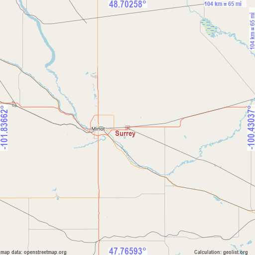
Surrey GPS coordinates[2]
48° 14' 11.04" North, 101° 8' 0.564" West
| Map corner | latitude | longitude |
|---|---|---|
| Upper-left | 48.70258°, | -101.83662° |
| Center: | 48.2364°, | -101.13349° |
| Lower-right: | 47.76593°, | -100.43037° |
| Map W x H: | 104.1×104.1 km | = 64.7×64.7mi |
| max Lat: | 71.29058° ⇑1.1% North |
| Surrey: | 48.2364° |
| min Lat: | ⇓98.9% South 19.06759° |
| min Long | Surrey | max Long |
| -171.73463° | -101.13349° | -66.98998° |
| W 18.6%⇐ | ⇒81.4% E |
Elevation
Elevation of Surrey is 499 m = 1637 ft, and this is 204.2 m = 670 ft above average elevation for this country.
| Max E: |
3189 m = 10463 ft | 12.2% |
| Surrey | 499 m 1637 ft | |
| Avg. | 294.8 m = 967 ft | |
Min E: |
-60 m = -197 ft | 87.8% |
See also: United States elevation on elevation.city.
Geographical zone
Surrey is located in North temperate zone (between Tropic of Cancer and the Arctic Circle). Distance of this North polar circle is 2037.8 km =1266.2 mi to North.| Distance of | km | miles | from Surrey |
|---|---|---|---|
| North Pole | 4643.7 | 2885.5 | to North |
| Arctic Circle | 2037.8 | 1266.2 | to North |
| Tropic Cancer | 2757.5 | 1713.4 | to South |
| Equator | 5363.4 | 3332.7 | to South |


Nearby cities:
15 places around Surrey: (largest is in red/bold)
• Berthold
45.5 km =28.3 mi,  280°
280°
• Bottineau
82.9 km =51.5 mi,  37°
37°
• Burlington
22.3 km =13.9 mi, 281°
• Garrison
68.3 km =42.4 mi,  197°
197°
• Kenmare
85.3 km =53 mi,  304°
304°
• Minot
12.1 km =7.5 mi,  267°
267°
• Minot Air Force Base
25.5 km =15.8 mi,  323°
323°
• Mohall
64.9 km =40.3 mi,  334°
334°
• Parshall
80.8 km =50.2 mi,  247°
247°
• Rugby
85.4 km =53.1 mi,  80°
80°
• Stanley
93.4 km =58 mi, 275°
• Towner
55.2 km =34.3 mi, 77°
• Turtle Lake
81.7 km =50.8 mi,  167°
167°
• Underwood
86.7 km =53.9 mi,  180°
180°
• Velva
25.1 km =15.6 mi,  142°
142°
Sources, notices
• [Note1] Compared only with cities in United States existing in our database
• [Src1] Map data: © OpenStreetMap contributors (CC-BY-SA)
• [Src2] Other city data from geonames.org with taken over terms of usage.
• [Src3] Geographical zone / Annual Mean Temperature by Robert A. Rohde @ Wikipedia
