Tryon geodata
Tryon (Nebraska) is a seat of a second-order administrative division; located in United States in America/Chicago (GMT-5) time zone. With population of 157 people, there are 21023 cities with bigger population in this country. Compared to other cities in United States, 71.4% of cities are located further ↓South; 81.3% of cities are located further →East and 93.4% of cities have lower elevation than Tryon. Note1


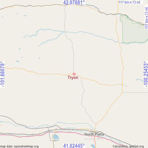
Tryon GPS coordinates[2]
41° 33' 9.972" North, 100° 57' 27.54" West
| Map corner | latitude | longitude |
|---|---|---|
| Upper-left | 42.07681°, | -101.66078° |
| Center: | 41.55277°, | -100.95765° |
| Lower-right: | 41.02445°, | -100.25453° |
| Map W x H: | 117×117 km | = 72.7×72.7mi |
| max Lat: | 71.29058° ⇑28.6% North |
| Tryon: | 41.55277° |
| min Lat: | ⇓71.4% South 19.06759° |
| min Long | Tryon | max Long |
| -171.73463° | -100.95765° | -66.98998° |
| W 18.7%⇐ | ⇒81.3% E |
Elevation
Elevation of Tryon is 998 m = 3274 ft, and this is 703.2 m = 2307 ft above average elevation for this country.
| Max E: |
3189 m = 10463 ft | 6.6% |
| Tryon | 998 m 3274 ft | |
| Avg. | 294.8 m = 967 ft | |
Min E: |
-60 m = -197 ft | 93.4% |
See also: United States elevation on elevation.city.
Geographical zone
Tryon is located in North temperate zone (between Tropic of Cancer and the Arctic Circle). Distance of this Northern Tropic circle is 2014.3 km =1251.6 mi to South.| Distance of | km | miles | from Tryon |
|---|---|---|---|
| North Pole | 5386.8 | 3347.2 | to North |
| Arctic Circle | 2780.9 | 1728 | to North |
| Tropic Cancer | 2014.3 | 1251.6 | to South |
| Equator | 4620.2 | 2870.9 | to South |


Nearby cities:
15 places around Tryon: (largest is in red/bold)
• Arnold
65.3 km =40.6 mi,  102°
102°
• Arthur
61.1 km =38 mi,  271°
271°
• Brewster
100.3 km =62.3 mi,  64°
64°
• Callaway
91 km =56.5 mi,  108°
108°
• Curtis
109.1 km =67.8 mi,  160°
160°
• Gothenburg
96.1 km =59.7 mi,  136°
136°
• Grant
101.8 km =63.3 mi,  219°
219°
• Hershey
44 km =27.3 mi,  184°
184°
• Hyannis
83.2 km =51.7 mi,  306°
306°
• Mullen
54.9 km =34.1 mi,  352°
352°
• North Platte
50.3 km =31.3 mi, 161°
• Ogallala
79.2 km =49.2 mi,  233°
233°
• Stapleton
37.9 km =23.5 mi, 102°
• Sutherland
46.2 km =28.7 mi,  197°
197°
• Thedford
56.9 km =35.4 mi,  33°
33°
Sources, notices
• [Note1] Compared only with cities in United States existing in our database
• [Src1] Map data: © OpenStreetMap contributors (CC-BY-SA)
• [Src2] Other city data from geonames.org with taken over terms of usage.
• [Src3] Geographical zone / Annual Mean Temperature by Robert A. Rohde @ Wikipedia
