Hershey geodata
Hershey (Nebraska) is a populated place; located in United States in America/Chicago (GMT-5) time zone. With population of 666 people, there are 19012 cities with bigger population in this country. Compared to other cities in United States, 67.5% of cities are located further ↓South; 81.3% of cities are located further →East and 92.6% of cities have lower elevation than Hershey. Note1


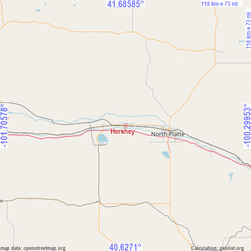
Hershey GPS coordinates[2]
41° 9' 30.996" North, 101° 0' 9.54" West
| Map corner | latitude | longitude |
|---|---|---|
| Upper-left | 41.68585°, | -101.70578° |
| Center: | 41.15861°, | -101.00265° |
| Lower-right: | 40.6271°, | -100.29953° |
| Map W x H: | 117.7×117.7 km | = 73.1×73.1mi |
| max Lat: | 71.29058° ⇑32.5% North |
| Hershey: | 41.15861° |
| min Lat: | ⇓67.5% South 19.06759° |
| min Long | Hershey | max Long |
| -171.73463° | -101.00265° | -66.98998° |
| W 18.7%⇐ | ⇒81.3% E |
Elevation
Elevation of Hershey is 886 m = 2907 ft, and this is 591.2 m = 1940 ft above average elevation for this country.
| Max E: |
3189 m = 10463 ft | 7.4% |
| Hershey | 886 m 2907 ft | |
| Avg. | 294.8 m = 967 ft | |
Min E: |
-60 m = -197 ft | 92.6% |
See also: United States elevation on elevation.city.
Geographical zone
Hershey is located in North temperate zone (between Tropic of Cancer and the Arctic Circle). Distance of this Northern Tropic circle is 1970.5 km =1224.4 mi to South.| Distance of | km | miles | from Hershey |
|---|---|---|---|
| North Pole | 5430.7 | 3374.5 | to North |
| Arctic Circle | 2824.8 | 1755.2 | to North |
| Tropic Cancer | 1970.5 | 1224.4 | to South |
| Equator | 4576.4 | 2843.6 | to South |


Nearby cities:
15 places around Hershey: (largest is in red/bold)
• Arnold
73.7 km =45.8 mi,  66°
66°
• Arthur
73.6 km =45.7 mi,  308°
308°
• Cozad
91.4 km =56.8 mi,  111°
111°
• Curtis
71.6 km =44.5 mi,  145°
145°
• Gothenburg
75.1 km =46.7 mi, 109°
• Grant
70.1 km =43.6 mi,  239°
239°
• Hayes Center
72 km =44.7 mi,  181°
181°
• Imperial
89.4 km =55.6 mi,  217°
217°
• North Platte
20.2 km =12.6 mi,  100°
100°
• Ogallala
60.1 km =37.3 mi,  266°
266°
• Stapleton
54.3 km =33.7 mi,  48°
48°
• Stockville
86.9 km =54 mi,  143°
143°
• Sutherland
10.4 km =6.5 mi, 268°
• Tryon
44 km =27.3 mi,  4°
4°
• Wauneta
88 km =54.7 mi,  200°
200°
Sources, notices
• [Note1] Compared only with cities in United States existing in our database
• [Src1] Map data: © OpenStreetMap contributors (CC-BY-SA)
• [Src2] Other city data from geonames.org with taken over terms of usage.
• [Src3] Geographical zone / Annual Mean Temperature by Robert A. Rohde @ Wikipedia
