Yakkabog‘ Shahri geodata
Yakkabog‘ Shahri (Qashqadaryo) is a seat of a second-order administrative division; located in Uzbekistan in Asia/Samarkand (GMT+5) time zone. In our database, there are 114 cities with bigger population. Compared to other cities in Uzbekistan, 91.4% of cities are located further ↑North; 57.5% of cities are located further →East and 78.7% of cities have lower elevation than Yakkabog‘ Shahri. Note1


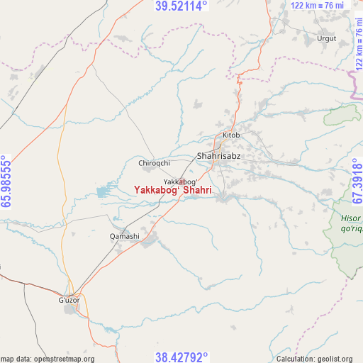
Yakkabog‘ Shahri GPS coordinates[2]
38° 58' 35.904" North, 66° 41' 19.212" East
| Map corner | latitude | longitude |
|---|---|---|
| Upper-left | 39.52114°, | 65.98555° |
| Center: | 38.97664°, | 66.68867° |
| Lower-right: | 38.42792°, | 67.3918° |
| Map W x H: | 121.6×121.6 km | = 75.6×75.6mi |
| max Lat: | 43.77877° ⇑91.4% North |
| Yakkabog‘ Shahri: | 38.97664° |
| min Lat: | ⇓8.6% South 37.22417° |
| min Long | Yakkabog‘ Sha | max Long |
| 58.84596° | 66.68867° | 72.76177° |
| W 42.5%⇐ | ⇒57.5% E |
Elevation
Elevation of Yakkabog‘ Shahri is 587 m = 1926 ft, and this is 153.2 m = 503 ft above average elevation for this country.
| Max E: |
1464 m = 4803 ft | 21.3% |
| Yakkabog‘ Shahri | 587 m 1926 ft | |
| Avg. | 433.8 m = 1423 ft | |
Min E: |
50 m = 164 ft | 78.7% |
See also: Uzbekistan elevation on elevation.city.
Geographical zone
Yakkabog‘ Shahri is located in North temperate zone (between Tropic of Cancer and the Arctic Circle). Distance of this Northern Tropic circle is 1727.9 km =1073.7 mi to South.| Distance of | km | miles | from Yakkabog‘ Shahri |
|---|---|---|---|
| North Pole | 5673.3 | 3525.2 | to North |
| Arctic Circle | 3067.4 | 1906 | to North |
| Tropic Cancer | 1727.9 | 1073.7 | to South |
| Equator | 4333.8 | 2692.9 | to South |


Nearby cities:
15 places around Yakkabog‘ Shahri: (largest is in red/bold)
• Charxin
80.4 km =50 mi,  4°
4°
• Chiroqchi
11.9 km =7.4 mi,  302°
302°
• Chiroqchi Shahri
10.9 km =6.8 mi, 301°
• G‘uzor
55 km =34.2 mi,  223°
223°
• G‘uzor Shahri
54.7 km =34 mi, 224°
• Juma
82.2 km =51.1 mi,  358°
358°
• Kitob
17.3 km =10.7 mi,  46°
46°
• Kitob Shahri
22.9 km =14.2 mi,  44°
44°
• Qamashi Shahri
26.1 km =16.2 mi,  228°
228°
• Qarshi
78.9 km =49 mi,  260°
260°
• Qorashina
71.4 km =44.4 mi,  188°
188°
• Samarkand
78.9 km =49 mi,  17°
17°
• Shahrisabz
15.5 km =9.6 mi, 54°
• Shahrisabz Shahri
14.2 km =8.8 mi, 53°
• Urgut
67.2 km =41.8 mi, 45°
Sources, notices
• [Note1] Compared only with cities in Uzbekistan existing in our database
• [Src1] Map data: © OpenStreetMap contributors (CC-BY-SA)
• [Src2] Other city data from geonames.org with taken over terms of usage.
• [Src3] Geographical zone / Annual Mean Temperature by Robert A. Rohde @ Wikipedia
